
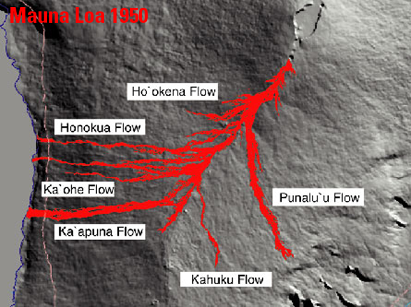
Map showing distribution of lava flows from 1950 eruption of Mauna Loa
By Hawaiian Volcano Observatory
1950 (approx.)
Detailed Description
Map showing distribution of lava flows from the 1950 eruption of Mauna Loa, Hawai'i.
Sources/Usage
Public Domain.
Related

1950 - Mauna Loa's Fastest High Volume Eruption
On June 1, 1950, a fissure erupted high on Mauna Loa's Southwest Rift Zone, and within 3 hours, ‘a‘ā lava flows had crossed the main highway on the west coast of the Island of Hawai‘i.
Related
1950 - Mauna Loa's Fastest High Volume Eruption
On June 1, 1950, a fissure erupted high on Mauna Loa's Southwest Rift Zone, and within 3 hours, ‘a‘ā lava flows had crossed the main highway on the west coast of the Island of Hawai‘i.