
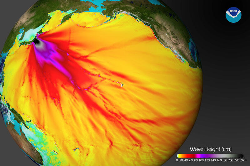
Max forecast wave amplitudes
By Pacific Coastal and Marine Science Center
2011 (approx.)
Detailed Description
Maximum forecast wave amplitudes for March 11, 2011, tsunami, computed with the MOST (Method of Splitting Tsunami) model. Note ray of tsunami energy refracted toward California and Oregon by seafloor topography. Image courtesy of the National Oceanic and Atmospheric Administration (NOAA) Center for Tsunami Research.
Sources/Usage
Public Domain.