
Orthoimagery Hoover Dam
By National Land Imaging Program
2005 (approx.)

Detailed Description
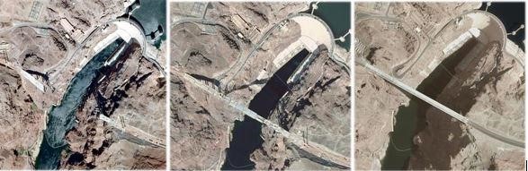
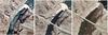
Orthoimagery, or imagery that has been geometrically corrected to improve horizontal accuracy, can present detailed imagery of land surface change such as these time-lapse images of the construction of the Hoover Dam Bypass bridge.
Sources/Usage
Public Domain.
Related

National Land Imaging Program: External Engagement
The National Land Imaging Program’s ongoing engagement with numerous external partners and stakeholders is what keeps the remote sensing world spinning.
Related
National Land Imaging Program: External Engagement
The National Land Imaging Program’s ongoing engagement with numerous external partners and stakeholders is what keeps the remote sensing world spinning.