
Overlap of areas suitable for wind and Mexican free-tailed bats
By Communications and Publishing
July 2024 (approx.)
Detailed Description
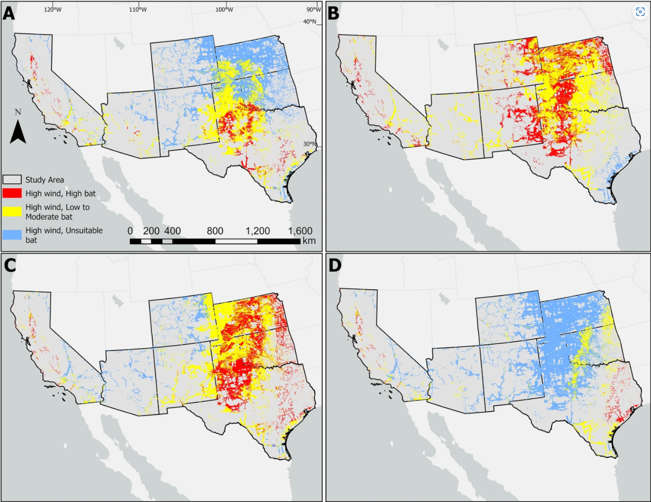
Maps showing predicted areas where highly suitable sites for wind turbines overlap with three levels of Mexican free-tailed bat (T. b. mexicana) habitat suitability in California, Arizona, New Mexico, Colorado, Texas, Oklahoma, and Kansas, USA during spring (A), summer (B), fall (C), and winter (D). The overlay analyses and maps were generated in ArcMap 10.6.1 (www.esri.com).
Sources/Usage
Public Domain.
From:
Huang, TK., Feng, X., Derbridge, J.J. et al. Potential for spatial coexistence of a transboundary migratory species and wind energy development. Sci Rep 14, 17050 (2024). https://doi.org/10.1038/s41598-024-66490-3