
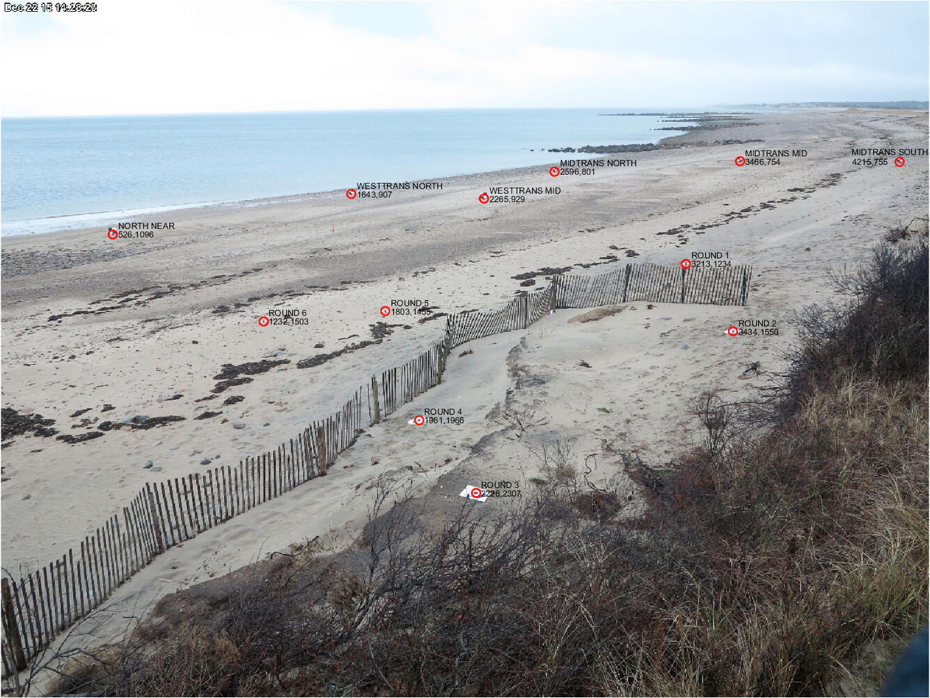
Photo marked with squares for pixel coordinates
By Woods Hole Coastal and Marine Science Center
December 2015 (approx.)
Detailed Description
Image from the beach cam with targets used to calibrate the images, allowing researchers to use pixel coordinates in the images to determine real-world locations.
Sources/Usage
Public Domain.