
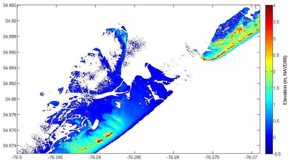
Post-Storm lidar topography at Core Banks, NC, from Aug. 28, 2011
By St. Petersburg Coastal and Marine Science Center
2011 (approx.)
Detailed Description
Post-storm lidar topography from August 28, 2011 for a portion of Core Banks, NC. The Irene breach is clearly seen in the post-storm lidar data. (The Atlantic Ocean is on the bottom right.)
Sources/Usage
Public Domain.