
Powder River Study Reach Map
Detailed Description
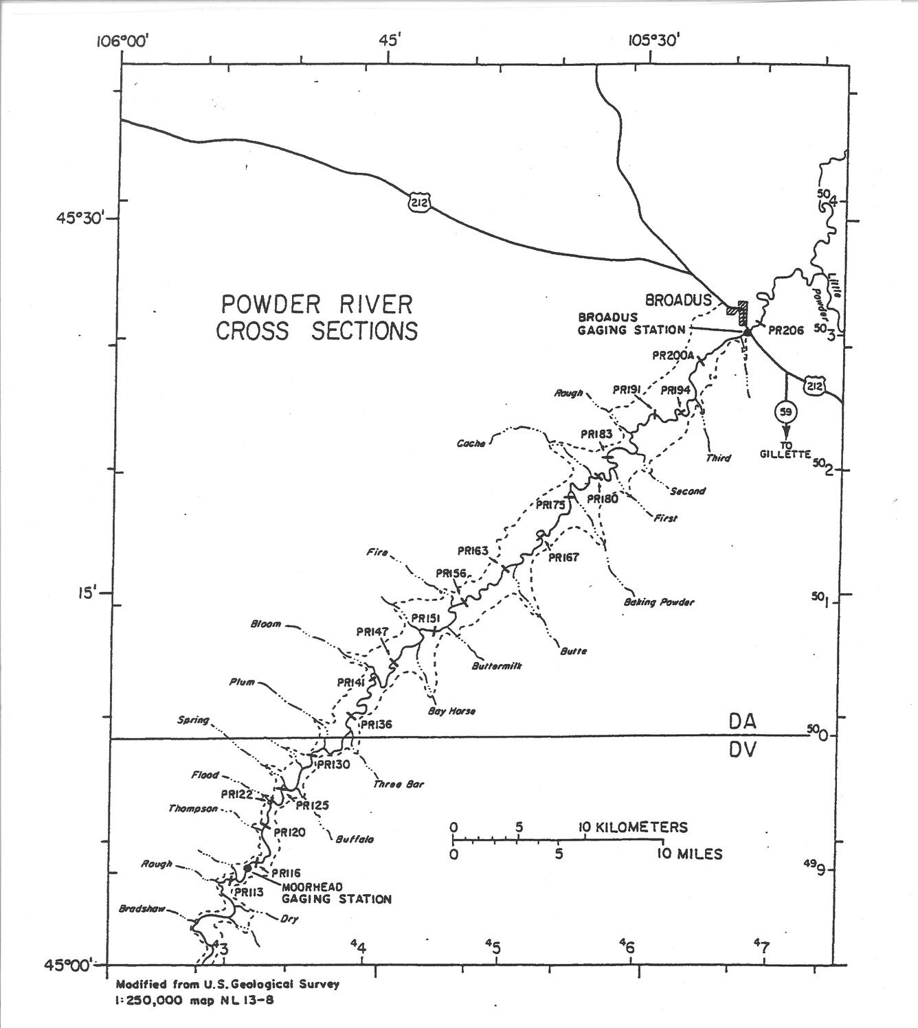
Map showing locations of 20 channel cross sections and the tributaries of Powder River in the study reach. The dashed line indicates the approximate boundary of the visually-obvious valley. Longitude and latitude tick marks are on the outside of the border, and tick marks for the universal transverse mercator (UTM) gride are on the inside of the border. DA and DV are the identification letters for the 100,000-meter-square grid. "Forty-fifth parallel" (45o 00' N) is the Montana-Wyoming state line. "PR113" is the cross section identification.
Sources/Usage
Public Domain.