
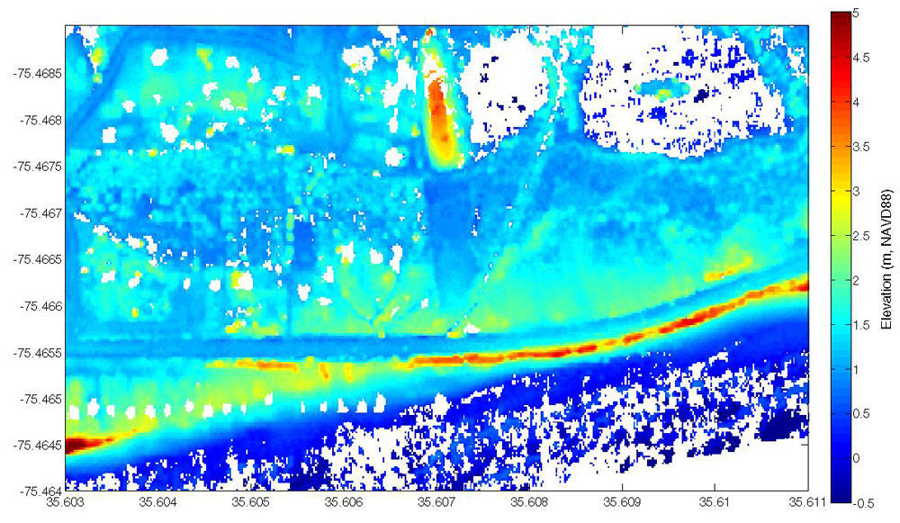
Pre-Storm lidar topography, Outer Banks, NC, from Nov. 27-Dec.1, 2009
By St. Petersburg Coastal and Marine Science Center
2011 (approx.)
Detailed Description
Pre-storm lidar topography from November 27-December 1, 2009, for a portion of the Outer Banks near Rodanthe, NC. In the pre-storm image, note where the road bends seaward, approaching the Atlantic Ocean. Here, the road is protected by sand filled bags that appear dune-like in the lidar topography. (The Atlantic Ocean is on the bottom right.)
Sources/Usage
Public Domain.