
Publicly Available Lidar Point Cloud Data Sept 2011

Detailed Description
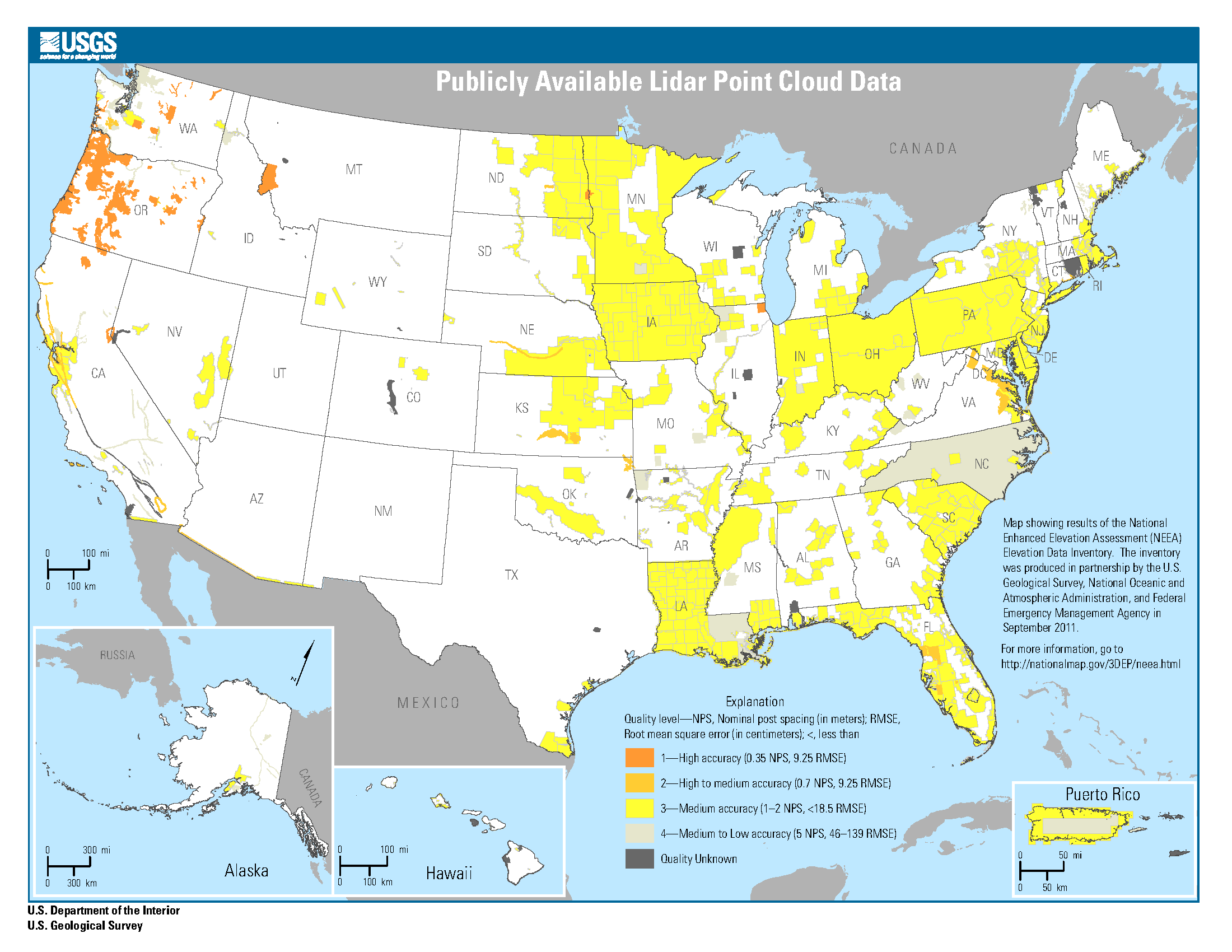
Publicly Available Lidar Point Cloud Data
Map showing results of the National Enhanced Elevation Assessment (NEEA) Elevation Data Inventory. The inventory
Map showing results of the National Enhanced Elevation Assessment (NEEA) Elevation Data Inventory. The inventory was produced in partnership by the U.S. Geological Survey, National Oceanic and Atmospheric Administration, and Federal Emergency Management Agency in September 2011.
For more information, go to https://usgs.gov/3DEP/neea
Explanation:
Quality level—NPS, Nominal post spacing (in meters); RMSE, Root mean square error (in centimeters); <, less than
Dark Orange: 1 - High accuracy (0.35 NPS, 9.25 RMSE)
Light Orange: 2 - High to medium accuracy (0.7 NPS, 9.25 RMSE)
Yellow: 3 - Medium accuracy (1–2 NPS, <18.5 RMSE)
Light Grey: 4 - Medium to Low accuracy (5 NPS, 46–139 RMSE)
Light Olive: 5 - Quality Unknown
Sources/Usage
Public Domain.