
Rio Grande Rise in southwest Atlantic Ocean
Detailed Description
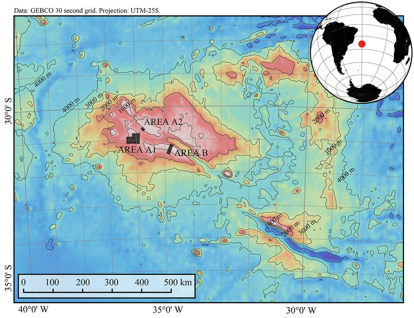
The Rio Grande Rise comprises two major seafloor features: a north-south string of seamounts that forms the eastern Rio Grande Rise, and an elliptical plateau that forms the western Rio Grande Rise, the focus of the January–February research cruise. Black rectangles show areas where the cruise dredged for rock samples. m, meters; km, kilometers.
Bathymetric data is taken from the GEBCO 30 second grid (www.gebco.net). Inset globe was produced using the Generic Mapping Tools (Wessel and Luis, 2017). Map was produced by Isobel Yeo (National Oceanography Centre Southampton).
Full data reference:
Gebco gridded global bathymetry data. British Oceanographic Data Centre, Liverpool, United Kingdom, 2009.
Wessel, P., and J. F. Luis, 2017, The GMT/MATLAB Toolbox, Geochem. Geophys. Geosyst., 18, 811-823, doi: 10.1002/2016GC006723
Sources/Usage
Public Domain.