
San Joaquin Valley Land Subsidence Monitoring Network (2000s - 2010s)
By Land Subsidence in California
2015 (approx.)

Detailed Description
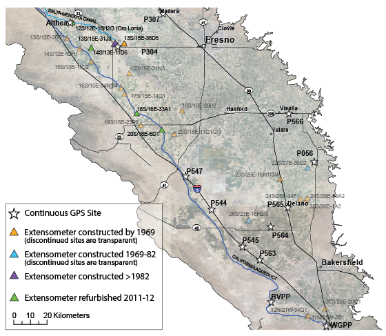
History of the San Joaquin Valley Land Subsidence Monitoring Network
California has experienced three droughts thus far in the 21st century (2001-2002, 2007-2009, and 2012-2016), bringing renewed subsidence to the San Joaquin Valley and the revitalization of the Monitoring Network. Four extensometers were refurbished in 2011-2012, which involved new reference tables and instrumentation, and the construction of new shelters. These were added to the six extensometers that were operating at five sites. Spirit-leveling and campaign GPS networks were generally maintained on major water-conveyance canals and highways only, and 13 Continuous GPS sites (maintained by various agencies/groups) are in operation on the Valley floor.
Sources/Usage
Public Domain.