
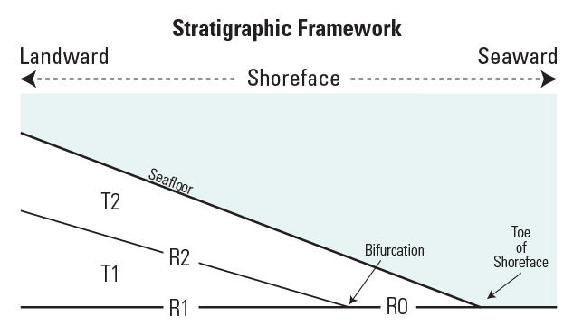
Schematic of naming conventions used for subsurface boundaries
Detailed Description
Schematic of naming conventions used for subsurface boundaries and sediment thickness maps. Horizon R0 bifurcates into R1 and R2 toward the west and landward. T1 and T2 are Holocene sediment sections. The full Holocene sediment thickness map is the section from R0+R1 to the seafloor (T1+T2). T2 is the active shoreface section or “reworked” Holocene sediments.
Sources/Usage
Public Domain.