
Sedimentary deposits from the 2001 Peru tsunami
By Pacific Coastal and Marine Science Center
September 2001 (approx.)
Detailed Description
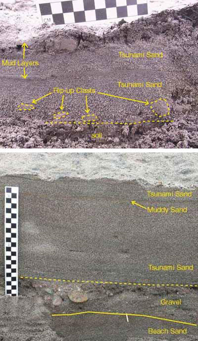
Top photo: Tsunami deposit at La Quinta overlying agricultural soil. A thin layer of mud divides the deposit into two distinct layers. A mud cap also covers the surface of the deposit. Note mud rip-up clasts above soil in bottom layer and mud rip-up beneath mud cap in top layer. Normal grading is clearly visible in the lower layer.
Bottom photo: Tsunami deposit at Amecosupe. Coarse material at base was eroded from a roadbed. Note eroded trample structures in underlying sand, thin mud layer near top of deposit, and current ripples from return flow at surface.