
Skagit_bathy.jpg
By Pacific Coastal and Marine Science Center
2020 (approx.)
Detailed Description
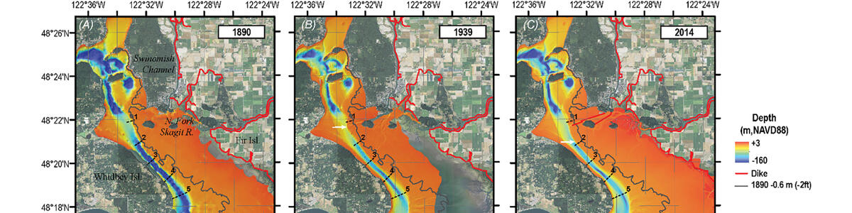
Map of the bathymetry of the Skagit River delta in 1890 (A), 1939 (B), and 2014 (C).
Sources/Usage
Public Domain.