
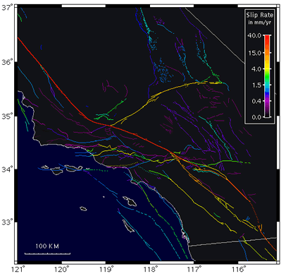
Slip Rate Map
By Earthquake Hazards Program
2021 (approx.)

Detailed Description
The slip rate is how fast the two sides of a fault are slipping relative to one another, as determined from geodetic measurements, from offset man-made structures, or from offset geologic features whose age can be estimated. It is measured parallel to the predominant slip direction or estimated from the vertical or horizontal offset of geologic markers.
Sources/Usage
Image courtesy of SCEC