
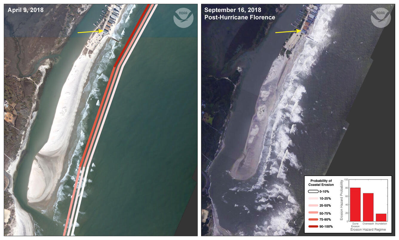
Southern end of Pawleys Island
Detailed Description
The southern end of Pawleys Island illustrates varying coastal responses to elevated water levels during Hurricane Florence. The inlet near the bottom of the image became wider and the low-lying sand spit was inundated due to high surge and waves while the beach to the north became narrower. Predicted probabilities of dune erosion and inundation were 80% and 0% for this location.
Sources/Usage
Public Domain.