
Survey area 2009
By Pacific Coastal and Marine Science Center
July 2009 (approx.)
Detailed Description
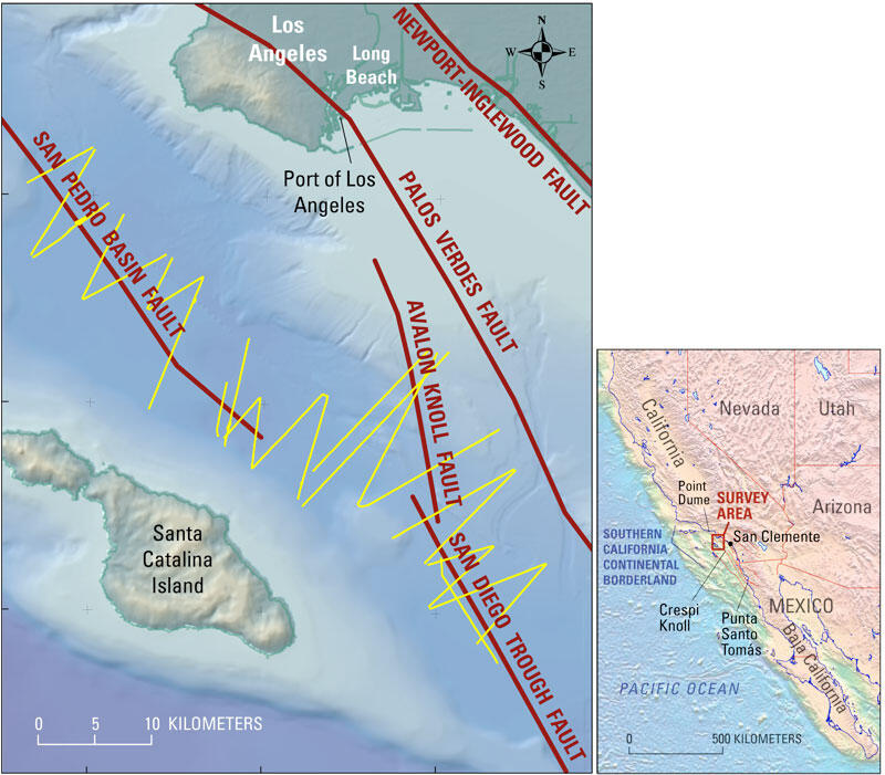
Survey area (large map). Thin yellow lines are the ship tracklines of the July 2009 cruise. Small map shows location of survey area and other placenames.
Sources/Usage
Public Domain.