
T-3 Track 1962-1974
Detailed Description
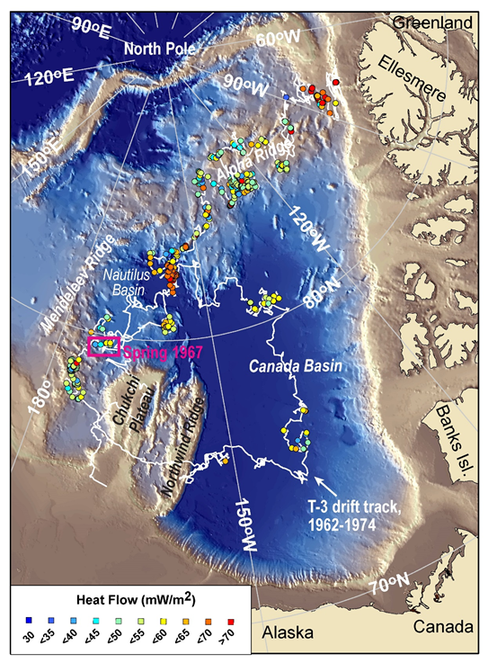
Track of drifting T-3 Ice Island around the Western Arctic Ocean from 1962 to 1974 with the 356 USGS heat flow points superposed as color-coded circles. The location of the aerial photograph taken in Spring 1967 is indicated by the pink box. Image provided by C. Ruppel, USGS.
Sources/Usage
Public Domain.