
Three-Dimensional Data Visualization
By Great Lakes Science Center
March 2025 (approx.)

Detailed Description
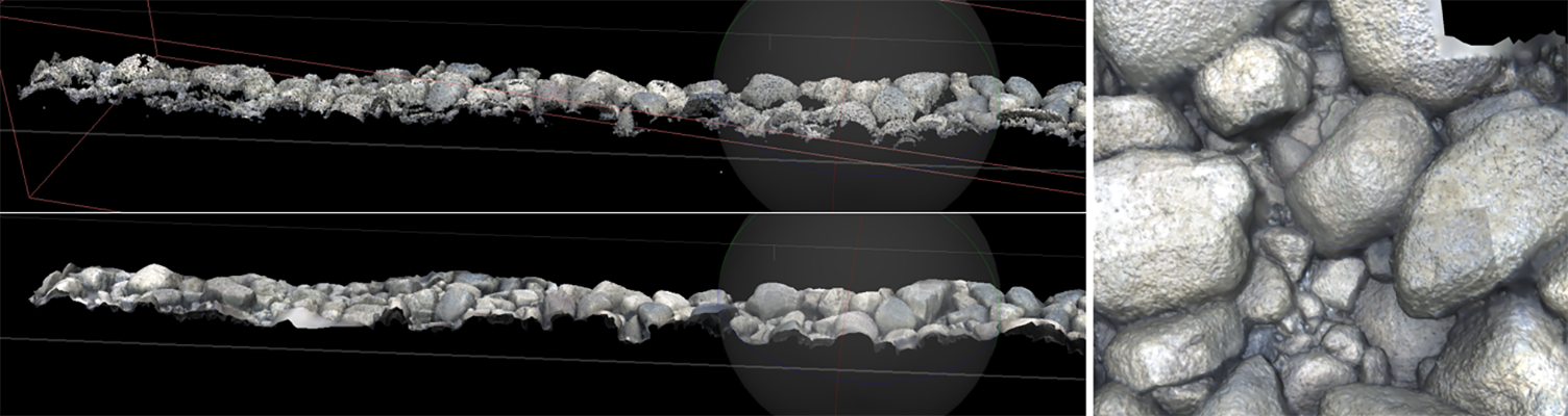
Three-dimensional reconstruction of a short section of lakebed imagery into a color point cloud (top) and orthomosaic (bottom), with a zoomed in view (right). These georeferenced data products are typical to many mobile platforms. Photo credit: Phil Wernette, USGS.
Sources/Usage
Public Domain.