
U.S. Coastal Wetland Geospatial Collection
Detailed Description
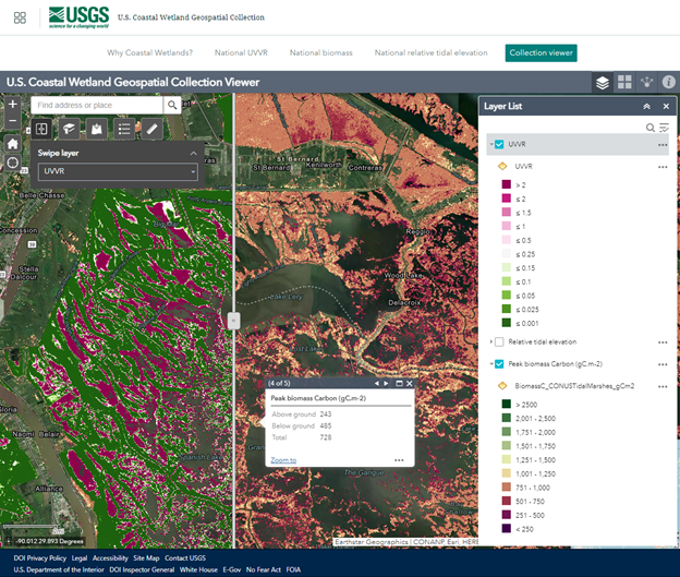
Users can navigate the collection by clicking on the tiles on the cover page or the tabbed menu. With the Collection viewer, users can use a swipe tool to compare layers and click to see the values for each pixel. Users can also add other data to the viewer and bookmark any locations of interest.
Sources/Usage
Public Domain.