
U.S. West Coast Map

Detailed Description
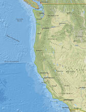
Map of the U.S. west coast, including offshore areas to be studied during the EXPRESS campaign.
Sources/Usage
Public Domain.
The National Map
As one of the cornerstones of the U.S. Geological Survey's (USGS) National Geospatial Program, The National Map is a collaborative effort among the USGS and other Federal, State, and local partners to improve and deliver topographic information for the Nation. It has many uses ranging from recreation to scientific analysis to emergency response.