
USGS Collects Sediments Samples at Pascagoula Beach

Detailed Description
U.S. Geological Survey (USGS) scientists collected environmental data and samples at beach, barrier island, and wetland sites in response to the 2010 Deepwater Horizon oil spill in the Gulf of Mexico. The USGS Florida, Alabama, Mississippi, Louisiana, and Texas Science Centers collaborated to collect samples of water and sediments for analysis of inorganic and organic constituents, benthic invertebrates, and oil and microorganism fingerprints before and after petroleum-associated product arrived on shore.
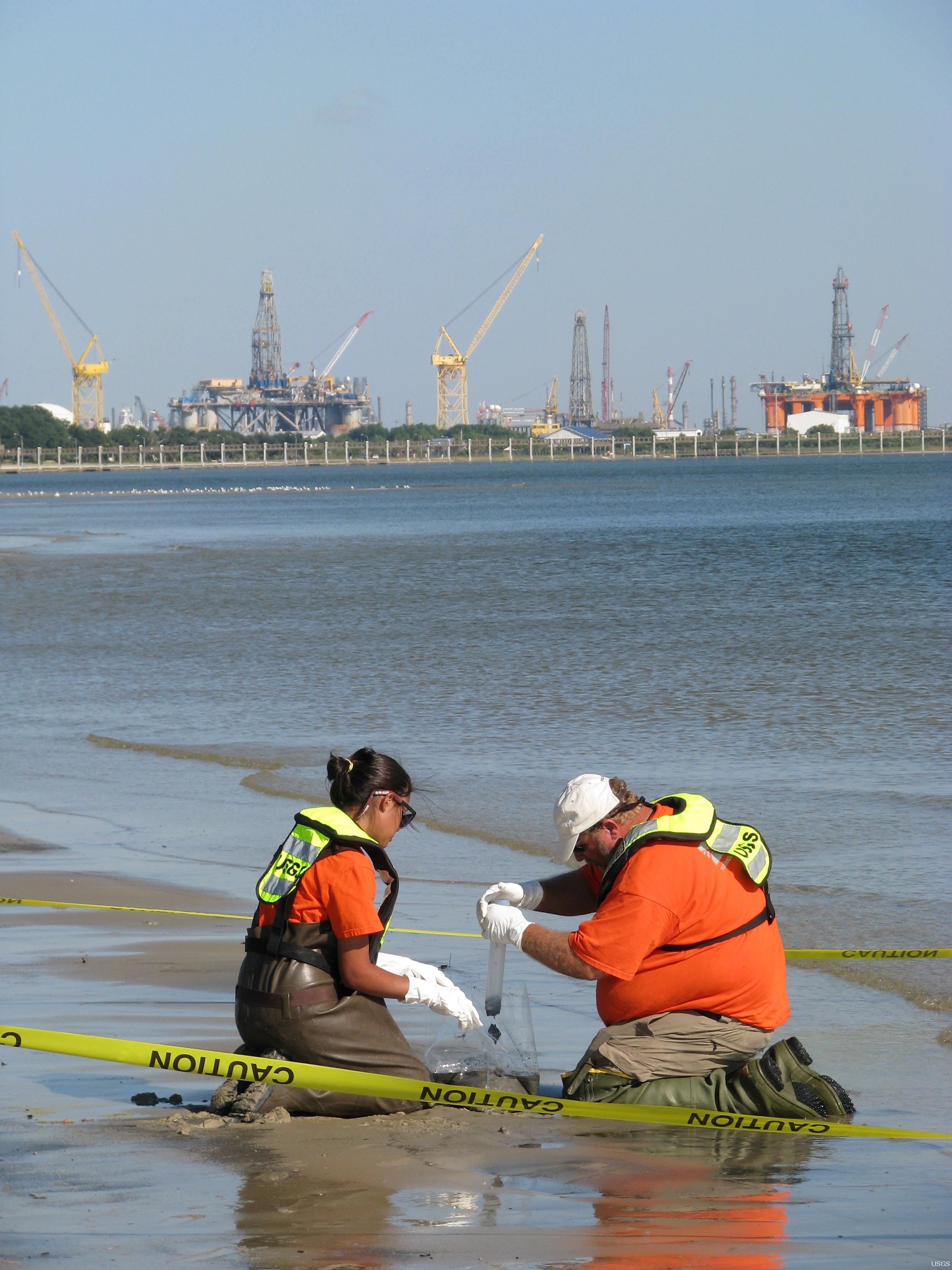
USGS Mississippi Water Science Center scientists Jessica Quintana and Darrell Wilson are collecting a bulk sediment sample at Pascagoula Beach, Pascagoula, MS (MS-45). Bulk sediment samples collected along the Gulf of Mexico shoreline are analyzed for oil-fingerprint, bacteria-fingerprint, metals, nutrients, oil and grease, and a suite of organic compounds. USGS analyses of the sediment will be used to identify chemical and biological changes that may have been caused by the arrival of crude oil product from the failure of the Deepwater Horizon well in April 2010.
You can view a map of related USGS sampling locations or access the data for sampling site MS-45.
Sources/Usage
Public Domain.