
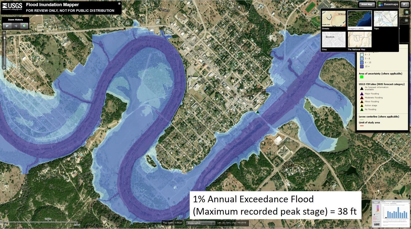
USGS Flood Inundation Mapper with water depth of 38 feet
By Communications and Publishing
August 2019 (approx.)
Detailed Description
A screenshot of the USGS Flood Inundation Mapper with a water depth layer corresponding to 38 feet at the USGS streamflow gaging station on the Medina River at Bandera, Texas.
Sources/Usage
Public Domain.