
USGS Groundwater Well Dates Back to 1874 (NWIS Site 430429089230301)
Detailed Description
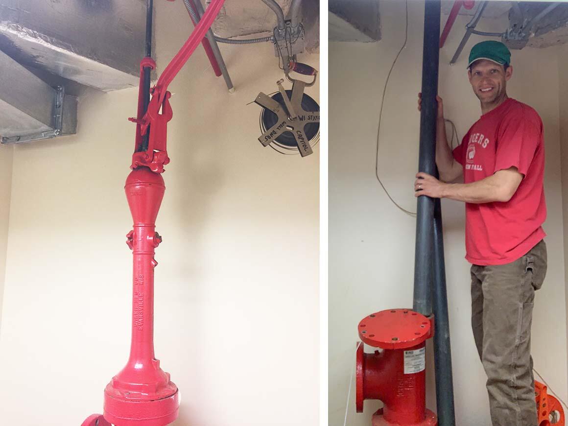
The first USGS groundwater level measurement recorded in this well is from 1874! The well was originally a flowing artesian well that was used as an active water supply. Routine monitoring began in 1946. This well, USGS NWIS Site 430429089230301, is located in the basement of the Wisconsin State Capitol in Dane County, Wisconsin, and is part of the USGS Upper Midwest Water Science Center’s groundwater monitoring network. Water level measurements from the well are used to help us monitor and understand local groundwater conditions, including in a 2016 groundwater flow model for Dane County.
Sources/Usage
Public Domain.