
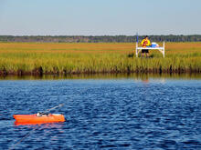
USGS works in estuaries and wetlands

Detailed Description
Photograph demonstrates how the USGS works in environments like wetlands and estuaries.
Sources/Usage
Public Domain.
The Coastal and Marine Hazards and Resources Program Decadal Strategic Plan 2020-2030
This geonarrative constitutes the Decadal Strategic Plan of the USGS's Coastal and Marine Hazards and Resources Program for 2020 to 2030.