
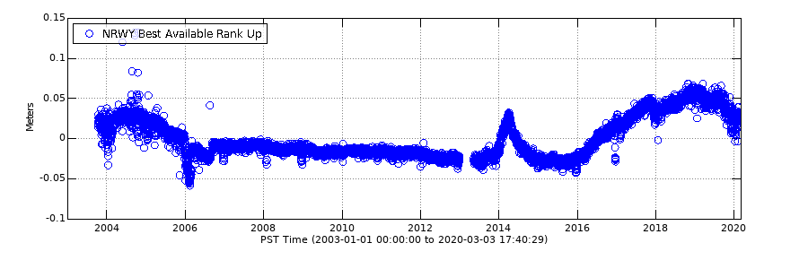
Vertical deformation near Norris Geyser Basin during 2003-2020 recorded by GPS
Detailed Description
Vertical deformation near Norris Geyser Basin during 2003-2020 recorded by GPS. Positive change is uplift and negative is subsidence.
Sources/Usage
Public Domain.
YVO