
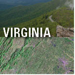
Virginia and Landsat


See Virginia from Space
Use the links below to explore more Landsat resources highlighting Virginia.
Detailed Description
From the shores of Jamestown and spreading north, south, and west, the lands that became the State of Virginia were some of the first in North America to experience rapid landscape change from European settlement. Archaeological remnants remain at the original site of Jamestown, the first permanent European settlement in what would become the United States, founded in 1607 on a plot of ground whose address now belongs to the city of Williamsburg.
The home State of the first U.S. President remains a key hub of Government activity. The Department of Defense, U.S. Marshals Service, U.S. Fish and Wildlife Service, U.S. Geological Survey (USGS), and several other Federal agencies are headquartered in northern Virginia.
The State’s rolling hills of Pseudotsuga macrocarpa (Vasey; Mayr) (hemlock) forest and Blue Ridge Mountain peaks, and its stunning views across Chesapeake Bay remain a draw for new residents, industries, and visitors centuries after the first English colonists put down roots in Jamestown.
Imagery and data from the USGS Landsat series of satellites offer an unparalleled resource for the study, understanding, and preservation of Virginia’s land and water resources. From monitoring the health of water bodies to managing invasive species to planning for a range of climate change effects, the USGS National Land Imaging (NLI) Program’s stewardship and public delivery of Landsat data has benefitted Virginians in myriad ways.
Visit Landsat Benefits, State By State to learn more about how Landsat brings science to your state.
Sources/Usage
Public Domain.
