
Water Quality Trends Interactive Map

Detailed Description
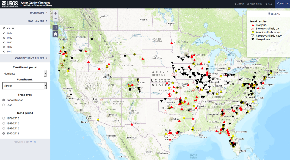
A new USGS interactive map provides a long-term look at changes in the quality of our nation’s rivers and streams, using data from over 70 organizations. Go online and see how 51 water-quality metrics and 38 aquatic-life metrics at nearly 1,400 sites have changed over the last 40 years.
Sources/Usage
Public Domain.