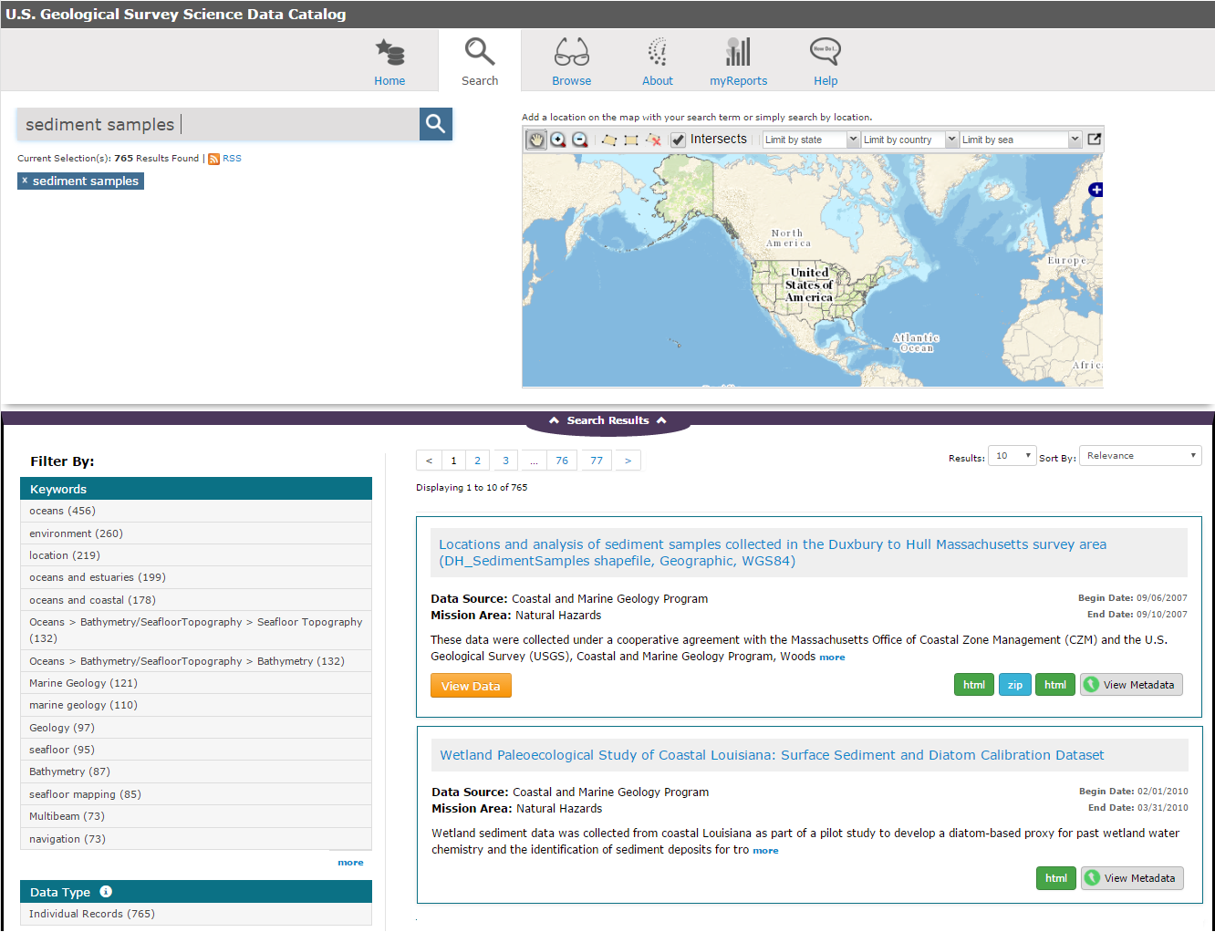
New USGS Science Data Catalog interface improves searches for USGS scientific data
The USGS Science Data Catalog (SDC) recently completed and launched a new and improved interface, making USGS data more accessible and discoverable for users. The USGS SDC is a searchable public data catalog for more than 7,000 USGS data assets and 20 USGS collections.
The USGS Science Data Catalog (SDC) recently completed and launched a new and improved interface, making USGS data more accessible and discoverable for users. The USGS SDC is a searchable public data catalog for more than 7,000 USGS data assets and 20 USGS collections.
The SDC was launched in January of 2014, in response to the White House Open Data Initiatives to make federally funded data more available and open to the public.
The SDC serves as the single point of entry that connects USGS data listings to the Department of the Interior and data.gov catalog. USGS programs and science centers partner with SDC as data providers to contribute data from a wide array of relevant science topics including energy and minerals, land cover, natural hazards, hydrology and ecosystems research.
To search for a USGS data asset, go to the Search page and enter one or more search terms. Alternatively users can search by location using the map tool. Results will be displayed with further information about each particular resource. Users can further sort or filter results to discover and explore data assets. The SDC will point to the location where the data can be downloaded.
Notable updates to the SDC include:
- New Home page – View frequently accessed USGS datasets and data highlighted from USGS programs and science centers
- Addition of collection-level datasets – Search datasets within large USGS collections (i.e. US Topo Maps and National Land Cover Dataset)
- New Browse page – Discover USGS datasets by browsing through newly implemented Science Topics, in addition to USGS Mission Areas and data sources represented by USGS Programs and Centers
- Easy-to-use myReports Page – For USGS data providers, easily access record reports and monitor the records that your center or program is providing to the SDC
- Data visualization feature for comma delimited value (.csv) data – Instantly visualize selected USGS data in comma separated value (.csv). Future improvements are continuing on this feature.
All USGS programs and science centers are encouraged to participate as data providers, as outlined in the new USGS Instructional Memoranda for Data Management.
For further information about SDC or how to visualize your csv datasets for users, contact sciencedatacatalog@usgs.gov.
The SDC was developed in collaboration with the US Department of Energy's Oak Ridge National Laboratory and also serves as a Member Node to the National Science Foundation sponsored DataONE project.
Get Our News
These items are in the RSS feed format (Really Simple Syndication) based on categories such as topics, locations, and more. You can install and RSS reader browser extension, software, or use a third-party service to receive immediate news updates depending on the feed that you have added. If you click the feed links below, they may look strange because they are simply XML code. An RSS reader can easily read this code and push out a notification to you when something new is posted to our site.


