
Photo & Video Chronology — April 18, 2025 — New Kīlauea summit interferogram and UAS mission photos
By Hawaiian Volcano Observatory
April 18, 2025
A new interferogram shows deformation at Kīlauea volcano during the pause between episodes 17 and 18 of the ongoing summit eruption.
Media

Sources/Usage: Public Domain. View Media Details
Media

On April 18, USGS Hawaiian Volcano Observatory geologists flew UAS (uncrewed aircraft systems) into Halemaʻumaʻu to monitor the ongoing Kīlauea summit eruption. This oblique aerial photo provides an overview of the two eruptive vents, north (background) and south (foreground). Both were steadily degassing, and the hole in the base of the south vent hosted a spattering lava pond a few tens of meters below the surface. These UAS flights were conducted with the permission of Hawaiʻi Volcanoes National Park, owing to the USGS Hawaiian Volcano Observatory's mission to monitor active volcanoes in Hawaii, assess their hazards, issue warnings, and advance scientific understanding to reduce the impacts of eruptions. Unauthorized launching, landing, or operating of a UAS from or on lands and waters administered by the National Park Service is prohibited under 36 CFR Closures & Public Use. USGS photo by M. Zoeller.
Sources/Usage: Public Domain. View Media Details
Media

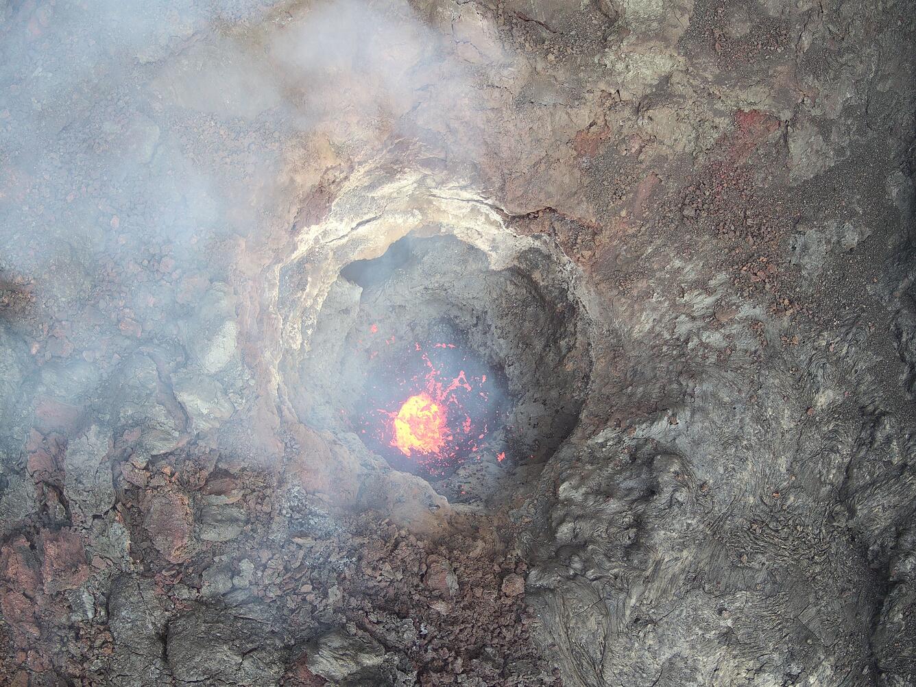
During UAS (uncrewed aircraft systems) overflights on April 18, the north vent within Halemaʻumaʻu at the summit of Kīlauea was vigorously degassing although it did not host any obvious active lava. This high-angle aerial photo shows multiple openings in the base of the vent cone that glowed hot in simultaneously captured thermal images. These UAS flights were conducted with the permission of Hawaiʻi Volcanoes National Park, owing to the USGS Hawaiian Volcano Observatory's mission to monitor active volcanoes in Hawaii, assess their hazards, issue warnings, and advance scientific understanding to reduce the impacts of eruptions. Unauthorized launching, landing, or operating of a UAS from or on lands and waters administered by the National Park Service is prohibited under 36 CFR Closures & Public Use. USGS photo by M. Zoeller.
Sources/Usage: Public Domain. View Media Details
Media
Sources/Usage: Public Domain. View Media Details
Get Our News
These items are in the RSS feed format (Really Simple Syndication) based on categories such as topics, locations, and more. You can install an RSS reader browser extension, software, or use a third-party service to receive immediate news updates depending on the feed that you have added. If you click the feed links below, they may look strange because they are simply XML code. An RSS reader can easily read this code and push out a notification to you when something new is posted to our site.