
Preparing the Nation for Coastal Hazards
USGS Provides Emergency Responders, Resource Managers, and Communities with the Science They Need to Safeguard Lives, Infrastructure, and Resources Along the Coast
Coasts, Storms, and Sea Level Rise Geonarratives
Check out some of our favorite tools and visually stunning interactive narratives describing our coastal work
Coastal Change Hazards
Learn more about our programmatic focus on coastal change hazards
Coastal and Marine Hazards and Resources Program
Explore the science conducted within CMHRP
The USGS Coastal and Marine Hazards and Resources Program is the federal science program dedicated to understanding how coastal and ocean processes impact our shorelines and seafloors. We’re focused on providing information that can be used to better protect your home, your community, and your way of life.
From predicting coastal flooding impacts of the next big storm to the slow and steady impact of sea level rise, we deliver data and tools providing vital knowledge that helps coastal communities prepare for and respond to coastal hazards.
Whether you're a mayor planning for the future, a homeowner worried about erosion, or a family looking forward to your next beach vacation, our work touches your life.

Our coastlines are home to millions of people, important wildlife, and beautiful scenery, but they face big challenges from big, impactful events like hurricanes to the steady changes caused by rising sea levels. Though natural hazards are unavoidable, their impact can be reduced with proper preparedness.
The USGS Coastal and Marine Hazards and Resources Program is a leader in natural hazards research. We study the impacts of multiscale hazards, like hurricanes and climate change, to inform strategies that protect people, roads, buildings, and nature along the coast.
Our science-based products are foundational to coordinated, national efforts to anticipate and effectively respond to coastal hazards on time scales from storms to sea level rise.
The assessments and scenarios we provide guide investments, management strategies, and policy choices targeted towards reducing economic and ecological losses and societal disruption.
We regularly engage with those who need scientific information to learn more about their specific needs and how best to meet them. Our intentional engagement and collaboration helps ensure the scope of our research is applicable and our data and science-based products are accessible, useful, and user-friendly.
Preparing for Current and Future Coastal Hazards
From hurricanes and storms to sea level rise
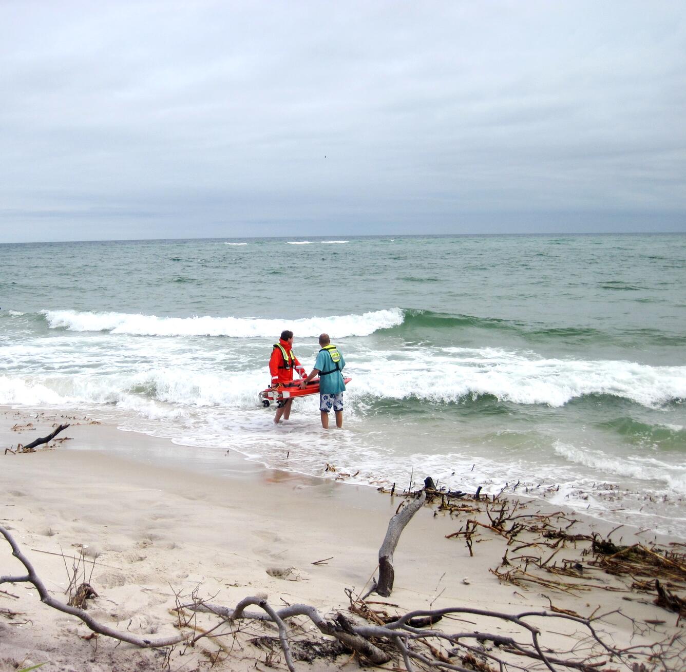
Of all recorded weather disasters in U.S. history, hurricanes and coastal storms cause the most death and destruction. From 1980-2023, they caused 6,890 deaths and cost 1.3 trillion dollars total in damages, averaging 22.8 billion dollars per event.2
In addition to impactful events like hurricanes and storms, gradual processes like sea level rise and erosion also threaten our coastal communities and livelihoods.
Sea level rise exacerbates coastal flooding, erosion, and hazards from storms. Higher water levels cause destructive storm surge to move farther inland. This threatens roads, bridges, water supplies, oil and gas wells, power plants, and other infrastructure needed for local and regional jobs and industries. Rising sea levels also mean more frequent high-tide flooding, which is not generally dangerous, but can be expensive and inconvenient. Additionally, sea level rise stresses coastal ecosystems that provide protection from storms, habitat for commercially valuable fisheries, and recreation.
Hurricanes
Rapidly intensifying tropical cyclones increase the threat and severity of erosion and flooding for coastal communities, putting millions of people and billions of dollars at risk. The demand for actionable information is increasing.
The USGS is the national leader in forecasting the potential impacts of landfalling storms on coastal environments. We produce the science and tools people need to improve preparedness, inform emergency response, and reduce loss of life and dollars.
We support preparation and response efforts to storms with coastal storm flooding and erosion data collection and forecasts during active storm events, and other extreme storms. On-the-ground field work, high-resolution monitoring data, and scientific modeling of events provides information to help land managers understand and prepare for future coastal vulnerability to storms and respond to changes in coastal landscapes caused by extreme storm events.

Tool Highlight: Coastal Change Hazards Portal
The Coastal Change Hazards (CCH) Portal is an interactive map with downloadable datasets and layers that displays extreme storms, shoreline changes, and sea level rise. Hurricane-induced coastal change hazard forecasts combine NOAA oceanographic modeling with USGS coastal processes models to provide both real-time guidance on likely coastal erosion, overwash, or flooding during an active storm, and scenario-based forecasts to prepare for future storms.
Read a more in-depth product summary in the Coastal Science Navigator.
Use Case: Colleagues from the University of Puerto Rico Rio Piedras used the scenario-based probabilities of hurricane-induced coastal change hazards to identify areas of the coastline that would be vulnerable to erosion during Tropical Storm Ernesto.

Future Storms
The USGS develops models that forecast potential impacts of storms both now and in the future when sea levels are higher. This information is used to inform flood management strategies.

Tool Highlight: Coastal Storm Modeling System (CoSMoS) - Our Coast, Our Future
CoSMoS models future coastal flooding and shoreline change (sandy beach change and cliff retreat) due to both sea level rise and storms. CoSMoS was designed to understand the present-day and future vulnerability of the coast in support of federal and state climate change guidance, local planning, and emergency response.
CoSMoS results are shared on the Our Coast, Our Future website. Our Coast, Our Future is a collaborative, user-driven project focused on serving coastal California resource managers and land use planners locally.
Read a more in-depth product summary in the Coastal Science Navigator.
Use Case: The City of Long Beach, California is developing an integrated Climate Action and Adaptation Plan and used CoSMoS data as part of its vulnerability assessment to better understand community vulnerability to coastal storms and sea level rise.
Read more case study examples on the Our Coast, Our Future webpage.
Coastal Hazards
Coastal change poses potential risks to coastal communities across the nation. Powerful storms generate surge, waves, and currents that can destroy roads, buildings, and other critical infrastructure, as well as alter natural habitats important for commercial and recreational purposes.
The USGS studies coastal conditions before, during, and after a storm to document and assess coastal change, risk, and vulnerability. We maintain a national database of shoreline measurements tracking rates of change and develop predictive models that help people understand and plan for coastal landscape evolution.

Tool Highlight: Total Water Level and Coastal Change Forecast Viewer
The Total Water Level and Coastal Change Forecast Viewer provides six-day, hourly forecasts of the magnitude, timing, and duration of total water level at the shoreline and likely coastal change impacts. This provides routine guidance of dangerous conditions to guide local decision-making.
Read a more in-depth product summary in the Coastal Science Navigator.
Use Case: The National Parks Service Outer Banks Group uses the Total Water Level and Coastal Change Forecast Viewer to determine when and where important roads (such as NC 12 on Ocracoke Island) might need to be closed due to overwash (when elevated water levels and waves transport sand inland).

Nature-Based Solutions
Nature-based solutions are actions that incorporate natural features and processes to protect, conserve, restore, sustainably use, and manage natural or modified ecosystems. On the coast, these natural features, including corals, wetlands, sand dunes, and sea grass, dissipate ocean energy and reduce risk from future storms.
USGS scientists describe and predict the impacts of climate change to various types of natural infrastructure and provide information to land managers who help implement protection of these features in coastal resilience and restoration efforts.

Coral Reefs As Protection from Storms
(Hawaii, Florida, Puerto Rico, U.S. Virgin Islands, American Samoa, Guam and the Commonwealth of the Northern Mariana Islands)
USGS models measure the protection coral reefs provide to people, businesses, and infrastructure. From this work we are gaining new insight into the structure of coral reefs, providing the basis for future monitoring, and understanding better both the influences of natural processes and impacts of human activities on coral reef health.
For more information visit the Coral Reefs as Coastal Protection web page.
Access report summary pamphlets and maps for each territory: The Value of U.S. Coral Reefs for Risk Reduction | U.S. Geological Survey (usgs.gov)
Use Case: Coral Reefs for Risk Reduction - USGS scientists provided research on role and value of coral reefs in protecting mainland environments to help coastal management agencies identify coral reef risks and assess insurance and federal assistance opportunities. In conjunction with U.S. Coral Task Force member groups (FEMA, USACE, NOAA, and academia), USGS contributed to a "Coral Reef Restoration for Risk Reduction (CR4)" guide for states, territories, local governments, and non-governmental organizations seeking pre- and post- disaster funding.
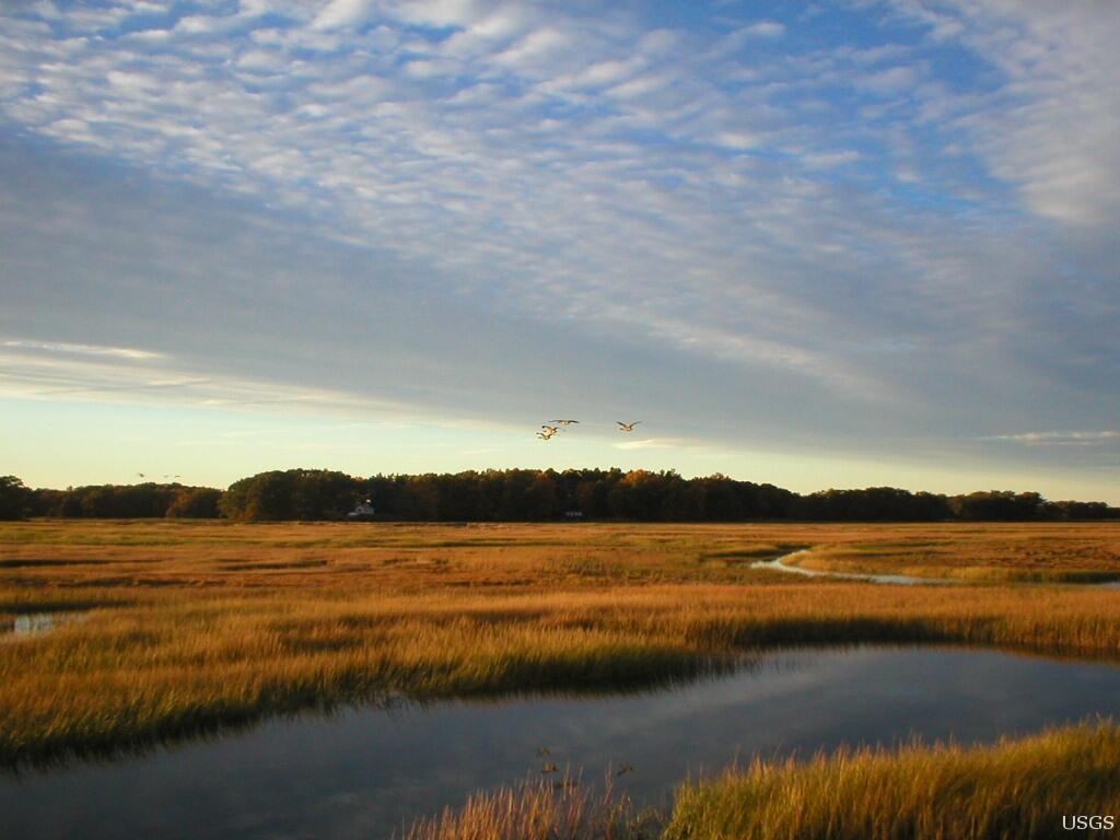
Coastal Wetland Assessments for Conservation and Restoration
(National and regional studies)
Identifying vulnerable and stable wetlands relative to sea level rise helps inform where to implement restoration and conservation strategies. Compiling and integrating foundational data a coastal wetland analysis provides land managers, such as those in National Wildlife Refuges, with the information needed to identify which coastal areas can naturally adapt to higher sea level and where restoration efforts should be focused.
For more information and to access an interactive website describing use-cases of how these data address national needs in the coastal zone, visit the U.S. Coastal Wetland Synthesis Applications geonarrative.
Use Case: The Wells National Estuarine Research Reserve (NERR) in Maine uses USGS marsh mapping data for state-wide restoration planning and is a strong advocate encouraging other NERRs to do the same. The collaboration between USGS and the Wells NERR acts as a catalyst for continued restoration research by introducing Federal, state, and non-governmental agencies to USGS geospatial products related to marsh health.

Sea Level Rise Impacts
Higher sea levels and storms lead to increased coastal erosion—a persistent and worsening problem. Waves and winds gradually carry away beach sand, shrinking beaches and exposing human infrastructure and sensitive archeological sites to tides and storms. Many beaches along the Nation’s coastline have lost more than six feet of shoreline a year over the last century. Coastal erosion estimates for much of the country are expected to increase in coming decades. Coupled with climate change, this creates hazardous conditions in most coastal communities.
The USGS develops computer models to study the complete coastal system, including how the coastline changes shape, ocean movement, and plant and animal dynamics. By considering these processes together, our scientists better understand how the coast might change in the future and can develop national scale forecast assessments.

Tool Highlight: Coastal Change Likelihood Assessment
(Maine, New Hampshire, Massachusetts, Rhode Island, Connecticut, New York, New Jersey, Delaware, Maryland, Virginia)
The Coastal Change Likelihood (CCL) assessment synthesizes over 20 existing datasets from a variety of federal, state, and private organizations to evaluate the likelihood of coastal change along U.S. coastlines on a decadal scale.
It was first developed for the Northeast, from Maine to Virginia, as a proof-of-concept study and work is in progress to expand coverage to the Great Lakes. The U.S. Department of Defense recognized the value of this assessment and is supporting a national expansion to help them assess and prepare for sea level rise risks to their coastal infrastructure.
For more information and to access the interactive geonarrative, data report, and data release, visit the CCL web page.
Use Case: The National Park Service (NPS) is using the Coastal Change Likelihood assessment to support archeological resource management in national parks.
“I see CCL as a tool that could support a wide variety of cultural resource management needs,” said Amanda Babson, Coastal Climate Adaptation Coordinator for the National Park Service in the North Atlantic-Appalachian Region. “If NPS cultural resources managers can demonstrate broad applicability, there are NPS programs beyond parks that could benefit, such as coastal National Historic Landmarks, Network to Freedom Underground Railroad sites or National Heritage Areas.”

Strong foundations enable great things to be built.
We are proud that the USGS provides the strong scientific foundation on which decision makers and other scientists and agencies rely.


Get Our News
These items are in the RSS feed format (Really Simple Syndication) based on categories such as topics, locations, and more. You can install and RSS reader browser extension, software, or use a third-party service to receive immediate news updates depending on the feed that you have added. If you click the feed links below, they may look strange because they are simply XML code. An RSS reader can easily read this code and push out a notification to you when something new is posted to our site.