USGS-Designed Tool Revolutionizes Seafloor Mapping
Researchers at the USGS Pacific and St. Petersburg Coastal and Marine Science Centers have developed new technology that provides imagery of complex three-dimensional seafloor features with unprecedented accuracy and geolocation.
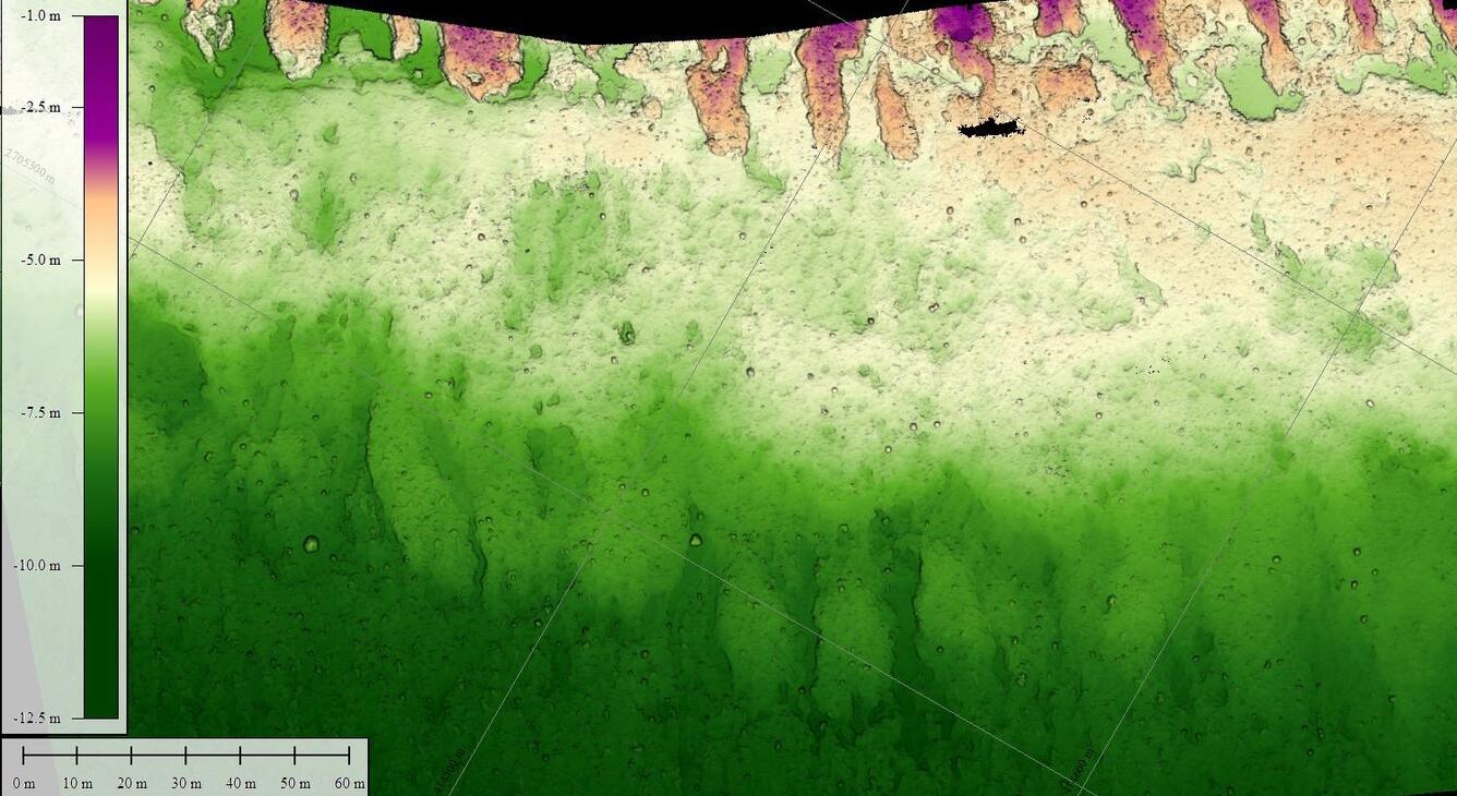
This innovation, named SQUID-5 (Structure-from-motion Quantitative Underwater Imaging Device with 5 cameras), creates incredibly detailed seafloor orthomosaics using structure-from-motion (SfM) techniques and the combination of digital imagery and precise global positioning (GPS) data.
Using recent advances in technology and newly developed equipment and software, SQUID-5 enables researchers to collect high-resolution images in shallow-water environments. At the core of SQUID-5's capabilities lies its employment of the SfM technique, which extracts three-dimensional information from that collection of two-dimensional images. The five fixed-position cameras on SQUID-5 capture multiple vantage points simultaneously while recording their precise GPS locations, creating data points that are then aggregated into a three-dimensional model. This transformation into accurate 3D models of the seafloor allows for the unprecedented mapping of intricate details of the seafloor.
The SQUID-5 system was originally designed to map nearshore coral reefs, an environment characterized by complex seabed surfaces in shallow, clear water. The system was initially tested during the pandemic at Dollar Point, a bedrock reef in Lake Tahoe, California, a site with the required characteristics—shallow, clear water with a complex bottom. Since the successful test there, the system has been deployed for USGS coral reef scientific mapping in the U.S. Florida Keys in 2021 and 2022.
The detailed 3D models generated by SQUID-5 allow researchers to study how complex underwater habitats change over time. These data are incredibly valuable to both scientists and resource managers and are being used for several different research and restoration efforts, including coral reef restoration projects in Florida and elsewhere.
“The ability to map large areas of coral reef with millimeter resolution and accurate geo-location allows researchers to track coral growth and/or loss on a reef over a spatial and temporal scale that was previously unattainable using other techniques,” said Gerry Hatcher, Ocean Engineer at Pacific Coastal and Marine Science Center’s Marine Facility and the lead engineer of SQUID-5. “These data are critical to understanding how coral reefs are faring given the multitude of threats they face, from warming ocean waters to acidification to coastal erosion and sea-level rise.”
Get Our News
These items are in the RSS feed format (Really Simple Syndication) based on categories such as topics, locations, and more. You can install and RSS reader browser extension, software, or use a third-party service to receive immediate news updates depending on the feed that you have added. If you click the feed links below, they may look strange because they are simply XML code. An RSS reader can easily read this code and push out a notification to you when something new is posted to our site.


