


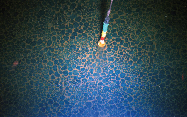
Over the last few weeks, Woods Hole scientists have been mapping the seafloor of Nantucket Sound as part of a long-term partnership with the State of Massachusetts.
We Make Treasure Maps: USGS Charts the Seafloor to Help Locate Critical Minerals, Precious Metals, and Other Vital Resources
By Coastal and Marine Hazards and Resources Program
April 2, 2025
USGS marks the spot! Our science is key to understanding seabed resources. Our maps characterizing the seafloor can help find critical minerals and other resources in high demand worldwide. While advancing scientific knowledge of the seafloor, USGS also leads a national effort to locate the critical minerals needed to drive the U.S. economy and national security. Some of the answer is under water.
As of June 2024, only 26.1% of the global seafloor has been mapped at high resolution. These offshore areas hold potential for energy and mineral resources crucial to our Nation. USGS scientists map, characterize, and sample the seafloor, helping to identify the areas most likely to contain these important natural resources, including oil, gas, sand, and critical minerals. Essentially, we make treasure maps.
Our findings inform industry and state and Federal government, such as the Bureau of Ocean Energy Management, the U.S. Department of Energy, and the U.S. Army Corps of Engineers, how and where seabed resources form, and help provide the science they need to make decisions about harnessing these resources safely and responsibly.
Media

Sources/Usage: Public Domain. View Media Details
USGS Marine Resources Research
Offshore Sand and Gravel
Offshore Sand and Gravel
Sand and gravel are essential resources for various construction and civil engineering applications. In addition to their use in concrete, mortar, plaster, and asphalt, these resources are needed for road stabilization, snow and ice management, beach replenishment, and creating artificial beaches. As foundational components of infrastructure development and coastal management, they are critical to our Nation’s economy.
The problem is these resources are finite. As land-based sources of sand and gravel become depleted or face increasing accessibility challenges, finding offshore sources is increasingly important.
By creating detailed maps of the seafloor and subseafloor, the USGS can advise state and Federal government on where sand and gravel deposits may be located offshore. These “treasure maps” are crucial for resource management, enabling informed decisions regarding responsible extraction of these materials. The USGS works directly with the State of Massachusetts to help identify promising offshore sources. We also collaborate with the BOEM Division of Marine Minerals and the USACE to better integrate our work into their comprehensive Regional Sediment Management plans—a systems approach using best management practices for more efficient and effective use of sediments in coastal, estuarine, and inland environments. The USGS has also partnered with BOEM to examine legacy datasets collected offshore of Texas and Louisiana to identify important sediment resources.
Ongoing mapping and research on what processes contribute to offshore sand and gravel deposits is vital in identifying new offshore sources, as well as understanding how and why deposits occur in certain regions, how to find more, and what disruptions may affect resource potential.
Media

Sources/Usage: Public Domain. View Media Details
Media

Sources/Usage: Public Domain. View Media Details
Media

Sources/Usage: Public Domain. View Media Details
Visit the Sea Floor Mapping Group web page to learn more about our geologic framework studies.
Sources/Usage: Public Domain. View Media Details

Deep Sea Minerals
Deep Sea Minerals
Many mineral resources and metals are vital to our Nation’s economy and national security. They are necessary manufacturing components for military hardware throughout the defense industrial base, including fighter jets and submarines, as well as for the technology and electronics we use every day, such as mobile batteries for power tools, smartphones, and vehicles.
Since Executive Order 13817 in 2017, the USGS has analyzed supply chains for these materials to develop the whole of government List of Critical Minerals. The list, due to be revised in June 2025, currently includes 50 minerals whose supply must be assured to avoid significant consequences to the United States economy and national security.
Across the USGS, research is underway to better understand the life cycle and supply chains of mineral resources, with a focus on those critical minerals. The Coastal and Marine Hazards and Resources Program maps the seafloor and provides the science necessary to characterize potential resources offshore.
Like minerals on land, deep sea minerals occur in a wide variety of settings related to Earth’s geologic framework and history. We investigate how and where they form, what conditions contribute to their growth, how long it takes for them to accumulate, identify where other similar minerals might occur, and assess the potential environmental signals associated with their extraction.
Our research focuses on the marine mineral categories that have the greatest resource potential, including manganese nodules, ferromanganese crusts, seafloor massive sulfides, and marine phosphorites.
Manganese nodules are spheroidal rocks that also form over millions of years, atop sediment covering the abyssal plains of the ocean. They are of great interest for mining due to high concentrations of manganese, nickel, copper, and sometimes lithium.
Ferromanganese crusts are seafloor pavements and encrusted rocks on the seafloor that grow very slowly, at several millimeters per million years, onto exposed rock surfaces throughout the ocean. They absorb metals and other elements from seawater over long periods of time and are especially enriched in cobalt, manganese, rare metals such as tellurium, precious metals such as platinum, and rare earth elements.
Seafloor massive sulfides, also known as polymetallic sulfides, form at hydrothermal vents from reduced sulfur. They may be enriched in copper, zinc, iron, gold, and silver.
Marine phosphorites form along continental margins where upwelling of cold, nutrient-rich, deep water is strong (i.e., Peru-Chile margin, Chatham Rise offshore New Zealand, and the Blake-Bahamas Plateau off the southeast United States) and on seamounts where ferromanganese crusts grow. They are sources of phosphate used as fertilizer for agriculture and phosphoric acid in the food industry. They also contain high concentrations of valuable, heavy, rare-earth elements.
Our scientists analyze mineral samples to understand their composition and metal content, examining how these factors vary across different regions. This helps identify promising areas in the ocean where mineral resources may exist by examining the relationship between ocean conditions and geographical features. We also investigate mineral stability and metal mobility by assessing how they react to seawater over time to learn how geochemical effects could disturb these resources.
We report our findings to U.S. leaders, industry, and the public so they can better understand the mineral wealth within the offshore territory of the United States and make decisions about which regions and resources warrant further research. We make the maps, our leaders decide on resource management, and private industry conducts exploration and proposes next steps.
Media

Sources/Usage: Public Domain. View Media Details
Media

Sources/Usage: Public Domain. View Media Details
Media

Sources/Usage: Public Domain. View Media Details
Visit the Global Seabed Mineral Resources project web page to learn more.
Sources/Usage: Public Domain. View Media Details

Gas Hydrates
Gas Hydrates
Finding new natural gas sources is of growing importance as our Nation strives for energy independence. As onshore reserves become depleted or more challenging to access, investigating potential offshore energy resources is crucial.
Gas hydrates are crystalline solids made of water and gas. It can look and feel much like ice, but contains huge amounts of methane. With support from the U.S. DOE, the USGS has led natural gas hydrate research for over 30 years in the deep sea and permafrost areas, collaborating with other Federal agencies to shape national research priorities.
We conduct mapping to better understand gas hydrate distribution, characterize methane hydrate deposits, and expand the number of known seafloor methane seeps.
One of our key research goals is investigating the potential of gas hydrate as an energy resource.
Our scientists participate in drilling, borehole logging, pressure coring, and other activities to study hydrate-bearing formations. We also conduct laboratory operations to analyze and interpret recovered sediments, hydrate, gas, and pore fluids to explain hydrate reservoir properties.
In 2024, we participated in the world’s first-ever long-term production test in a permafrost setting near Prudhoe Bay, Alaska—an important next step toward demonstrating gas hydrate’s potential as an energy resource. This work was done in collaboration with the Japan Organization for Metals and Energy Security (JOGMEC), Japan’s National Institute of Advanced Industrial Science and Technology (AIST), and the U.S. DOE.
The USGS will continue to study gas hydrates and evaluate long-term production test results to determine if gas hydrates are a viable energy resource for our Nation.
Media

Sources/Usage: Public Domain. View Media Details
Media

Sources/Usage: Public Domain. View Media Details
Media

Sources/Usage: Public Domain. View Media Details
Visit the Gas Hydrates – Energy web page to learn more.
Sources/Usage: Public Domain. View Media Details

As we continue to map the seafloor, we pave the way for responsible offshore resource management that will protect our national security and benefit the Nation’s economy.


Related
Global Seabed Mineral Resources
The Global Marine Mineral Resources project studies deep ocean minerals that occur within the U.S. Exclusive Economic Zone and areas beyond national jurisdictions. Our research concerns the setting, genesis, and metal enrichment processes of mineral occurrences, the relationship between marine minerals and deep-sea biota, and the potential geochemical footprint of any seafloor mining. We aim to...
U.S. Geological Survey Gas Hydrates Project
The USGS Gas Hydrates Project has been making contributions to advance understanding of US and international gas hydrates science for at least three decades. The research group working on gas hydrates at the USGS is among the largest in the US and has expertise in all the major geoscience disciplines, as well as in the physics and chemistry of gas hydrates, the geotechnical properties of hydrate...
Sea Floor Mapping Group
The Sea Floor Mapping Group (SFMG) is a core capability at the Woods Hole Coastal & Marine Science Center (WHCMSC) that provides support for coastal, lacustrine and marine geologic research. The staff has a wide-range of expertise and is responsible for geophysical and sampling data acquisition, processing, interpretation and publication, logistics, design, and research and development. SFMG has...
Gas Hydrates- Energy
Natural gas production from methane hydrates may someday prove viable. The USGS Gas Hydrate Project takes part in US and international programs to investigate the potential of deepwater marine and permafrost gas hydrates as an energy resource. Long-term production tests are the next step in this research.
Gas Hydrates - Primer
What is Gas Hydrate? Gas hydrate is an ice-like crystalline form of water and low molecular weight gas (e.g., methane, ethane, carbon dioxide). On Earth, gas hydrates occur naturally in some marine sediments and within and beneath permafrost. Gas hydrates have also been inferred on other planets or their moons.

Bon Voyage, Rafael
Over the last few weeks, Woods Hole scientists have been mapping the seafloor of Nantucket Sound as part of a long-term partnership with the State of Massachusetts.
Related
Global Seabed Mineral Resources
The Global Marine Mineral Resources project studies deep ocean minerals that occur within the U.S. Exclusive Economic Zone and areas beyond national jurisdictions. Our research concerns the setting, genesis, and metal enrichment processes of mineral occurrences, the relationship between marine minerals and deep-sea biota, and the potential geochemical footprint of any seafloor mining. We aim to...
U.S. Geological Survey Gas Hydrates Project
The USGS Gas Hydrates Project has been making contributions to advance understanding of US and international gas hydrates science for at least three decades. The research group working on gas hydrates at the USGS is among the largest in the US and has expertise in all the major geoscience disciplines, as well as in the physics and chemistry of gas hydrates, the geotechnical properties of hydrate...
Sea Floor Mapping Group
The Sea Floor Mapping Group (SFMG) is a core capability at the Woods Hole Coastal & Marine Science Center (WHCMSC) that provides support for coastal, lacustrine and marine geologic research. The staff has a wide-range of expertise and is responsible for geophysical and sampling data acquisition, processing, interpretation and publication, logistics, design, and research and development. SFMG has...
Gas Hydrates- Energy
Natural gas production from methane hydrates may someday prove viable. The USGS Gas Hydrate Project takes part in US and international programs to investigate the potential of deepwater marine and permafrost gas hydrates as an energy resource. Long-term production tests are the next step in this research.
Gas Hydrates - Primer
What is Gas Hydrate? Gas hydrate is an ice-like crystalline form of water and low molecular weight gas (e.g., methane, ethane, carbon dioxide). On Earth, gas hydrates occur naturally in some marine sediments and within and beneath permafrost. Gas hydrates have also been inferred on other planets or their moons.
Bon Voyage, Rafael
Over the last few weeks, Woods Hole scientists have been mapping the seafloor of Nantucket Sound as part of a long-term partnership with the State of Massachusetts.
Over the last few weeks, Woods Hole scientists have been mapping the seafloor of Nantucket Sound as part of a long-term partnership with the State of Massachusetts.
Get Our News
These items are in the RSS feed format (Really Simple Syndication) based on categories such as topics, locations, and more. You can install and RSS reader browser extension, software, or use a third-party service to receive immediate news updates depending on the feed that you have added. If you click the feed links below, they may look strange because they are simply XML code. An RSS reader can easily read this code and push out a notification to you when something new is posted to our site.