
Hampton Roads Water Quality Dashboard
Hampton Roads Water Quality Monitoring Dashboard
Visualizing Water Quality Data in the Hampton Roads Stormwater System
About this Tool
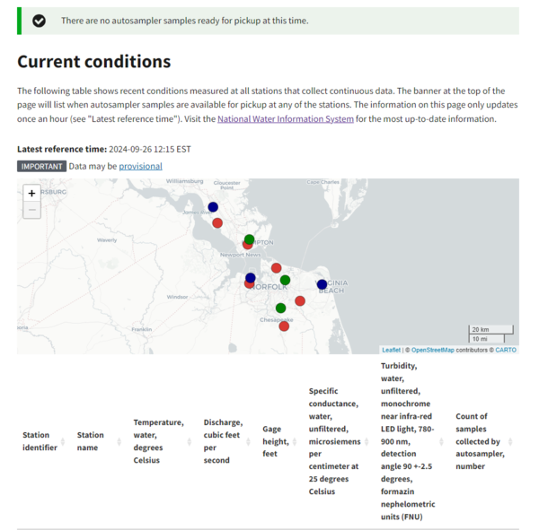
The Hampton Roads Water Quality Dashboard displays data from 12 water-quality monitoring stations across the cities of Chesapeake, Hampton, Newport News, Norfolk, Portsmouth, and Virginia Beach. This application provides access to current conditions at each monitoring station and visualize timeseries plots for continuously monitored parameters collected at each monitoring stations.
Dashboard features
See current conditions: see the latest conditions at each intensive monitoring station across the cities of Chesapeake, Hampton, Newport News, Norfolk, Portsmouth, and Virginia Beach.
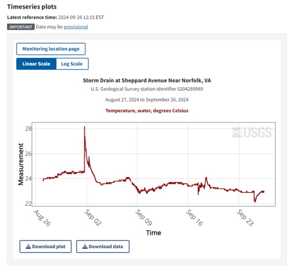
Visualize continuous data timeseries: view timeseries plots for continuously monitored parameters collected at each intensive monitoring station in six major cities across the Hampton Roads region. .
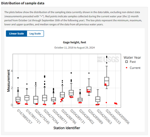
Find discrete sampling data: access and visualize distributions of discrete sampling data collected at intensive and trend monitoring across the Hampton Roads region.
Related
Explore U.S. Geological Survey science related to water resources monitoring , and water quality.

Hampton Roads Regional Water Quality Monitoring Program
Related
Explore U.S. Geological Survey science related to water resources monitoring , and water quality.