U.S. flag

An official website of the United States government

June 9, 2022

An eruption at Kīlauea's summit began at approximately 3:20 p.m. HST on September 29, 2021. Lava activity is confined within Halema‘uma‘u crater, in the closed area of Hawai‘i Volcanoes National Park.

HVO scientists collect detailed data to assess hazards and understand how the eruption is evolving at Kīlauea's summit, all of which are shared with the National Park Service and emergency managers. Access to this hazardous area is by permission from, and in coordination with, Hawai‘i Volcanoes National Park.

June 8, 2022 — Kīlauea summit eruption ongoing

Color photograph of lava lake
At the summit of Kīlauea, the eruption within Halema‘uma‘u continues. Hawaiian Volcano Observatory geologists conducted a field observation shift the morning of June 8. From the south rim of Halema‘uma‘u, the active lava lake in the west portion of the crater was nearly full and the surface crust was slowly moving west to east. In this panoramic image, volcanic gas is visibly emanating from much of Halema‘uma‘u crater floor and Mauna Loa can be seen in the background. USGS photo by K. Mulliken.
Color photograph of lava lake
In this telephoto image taken from the south rim of Halema‘uma‘u, spattering and crustal foundering is visible in the east end of the active lava lake within the crater at Kīlauea's summit. Slabs of thin silvery crust are visible covering most of the lava lake surface; this crust was moving in a west-to-east motion the morning of June 8. USGS photo by J. Schmith.
Color photograph of crater floor
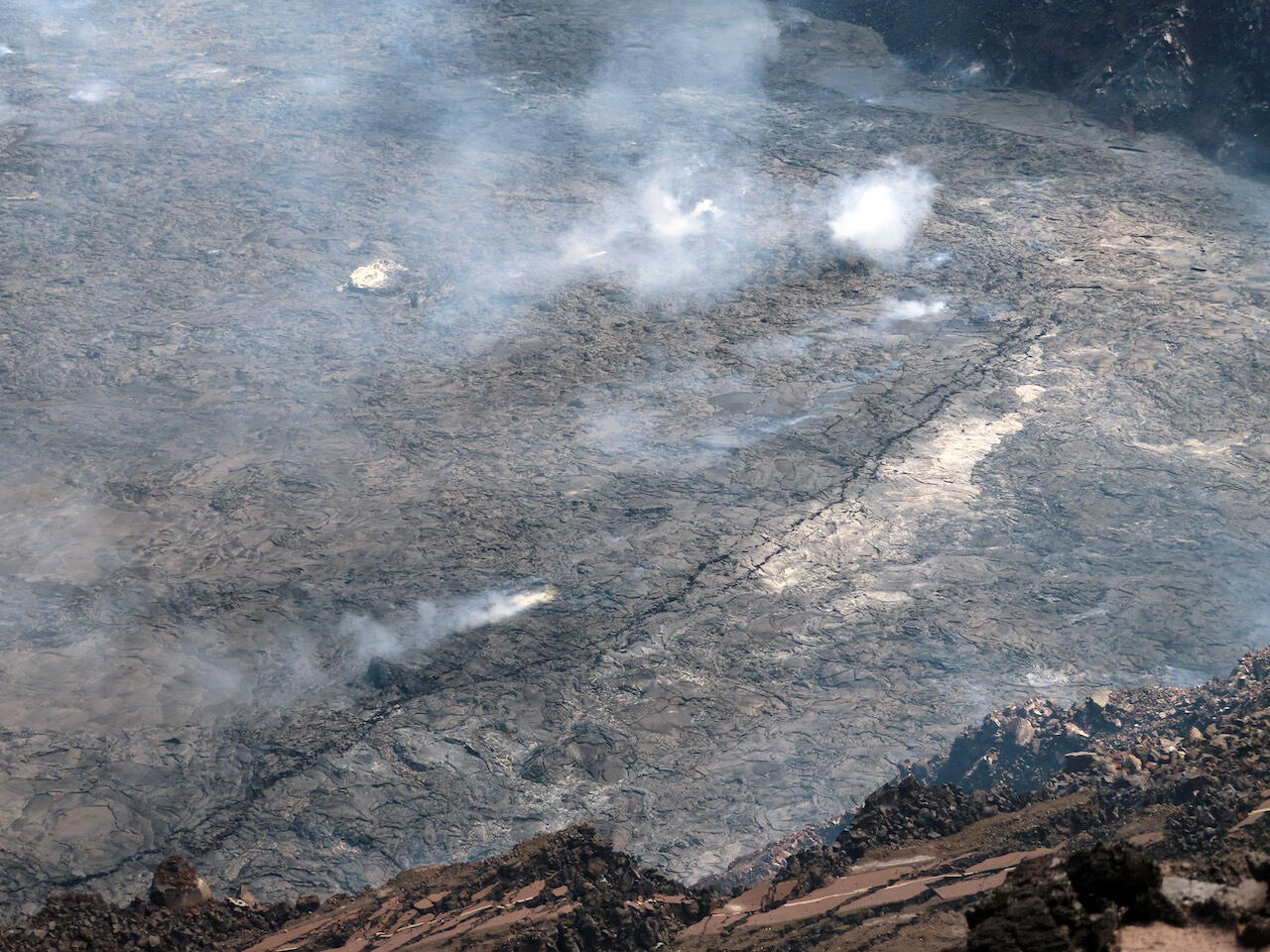
The crater floor of Halema‘uma‘u at the summit of Kīlauea is covered with lava flows erupted since the current eruption began on September 29, 2022. These lava flows are a patchwork of different ages, with overflows and ooze-outs along the margin of the crater floor covering new portions of the crater floor at different times. At the same time, the entire crater floor continues to rise as lava is supplied beneath the solidified crust, lifting the surface. This process is visible in this timelapse sequence: https://www.usgs.gov/media/videos/rise-halemaumau-crater-floor. USGS photo by J. Schmith.
Color photograph of volcanic vent
Telephoto image of the west vent area within Halema‘uma‘u crater at the summit of Kīlauea. During an HVO geology observation shift on June 8, the west vent area was steaming and degassing as were many other areas of the crater floor. A low roaring sound could be heard from the south rim of the crater, which seemed to come from the vent area. USGS photo by J. Schmith.
Color photograph of crater floor
This telephoto image, taken from the south rim of Halema‘uma‘u, shows the island of tephra that formed during the earliest stages of Kīlauea's summit eruption that began the evening of December 20, 2020. Lava erupted during the ongoing eruption continues to lap onto this feature, slowly burying it. In the lower left quadrant of this image, a small kīpuka of the island is visible; this Kīpuka has formed as younger lava flows continue to fill in and surround the island. USGS photo by J. Schmith.

June 7, 2022 — Kīlauea Southwest Rift Zone Seismic Nodes Being Deployed

Color photograph of scientists in field
Hawaiian Volcano Observatory (HVO) staff, along with collaborators from the University of Hawai‘i at Mānoa, are installing seismic nodes on the Southwest Rift Zone of Kīlauea this week as part of a project funded by the Additional Supplemental Appropriations for Disaster Relief Act of 2019 (H.R. 2157). With permission from Hawai‘i Volcanoes National Park and other landowners, the seismic nodes are being temporarily deployed over the summer to record ground shaking generated by earthquakes. HVO scientists will use the data to create images of the structure of the Earth beneath Pāhala from as great as 40–50 km (25–31 miles) below sea level all the way to the surface. You can learn more about the project in this “Volcano Watch” article: https://www.usgs.gov/observatories/hvo/news/volcano-watch-using-earthquakes-look-under-hood-pahala. USGS photo by N. Bennington.
Color photograph of scientist with instrument in the field
Unlike permanent seismic stations, which are placed farther apart and cover the entire Island of Hawai‘i, the temporary seismic nodes will be tightly grouped in order to more densely record earthquake signals across the region surrounding Pāhala. This photo shows a University of Hawai‘i at Mānoa graduate student deploying a seismic node—light, compact seismometers that measure ground shaking at the location where they are placed. You can learn more about the project in this “Volcano Watch” article: https://www.usgs.gov/observatories/hvo/news/volcano-watch-using-earthquakes-look-under-hood-pahala. USGS photo by N. Bennington.

Get Our News

These items are in the RSS feed format (Really Simple Syndication) based on categories such as topics, locations, and more. You can install and RSS reader browser extension, software, or use a third-party service to receive immediate news updates depending on the feed that you have added. If you click the feed links below, they may look strange because they are simply XML code. An RSS reader can easily read this code and push out a notification to you when something new is posted to our site.

Was this page helpful?