An official website of the United States government
Here's how you know
Official websites use .gov
A .gov website belongs to an official government organization in the United States.
Secure .gov websites use HTTPS
A lock () or https:// means you’ve safely connected to the .gov website. Share sensitive information only on official, secure websites.
Short-lived explosion at Halema‘uma‘u crater, 8:27 a.m. HST
Ash column rises from the Overlook crater at the summit of Kīlauea Volcano. HVO's interpretation is that the explosion was triggered by a rockfall from the steep walls of Overlook crater. The photograph was taken at 8:29 a.m. HST from the Jaggar Museum overlook. The explosion was short-lived. Geologists examining the ash deposits on the rim of Halema‘uma‘u crater found fresh lava fragments hurled from the lava lake. This explosion was not caused by the interaction of the lava lake with the water table. When the ash cleared from the crater about an hour after the explosion, geologists were able to observe the lava lake surface, which is still above the water table.
09:53 a.m. HST. Ground cracks show cherry-red interior at fissure 14 in Leilani Subdivsion
Yellow lines show offset cracks on Lelani Avenue, Leilani Subdivsion at 10:10 a.m. HST.
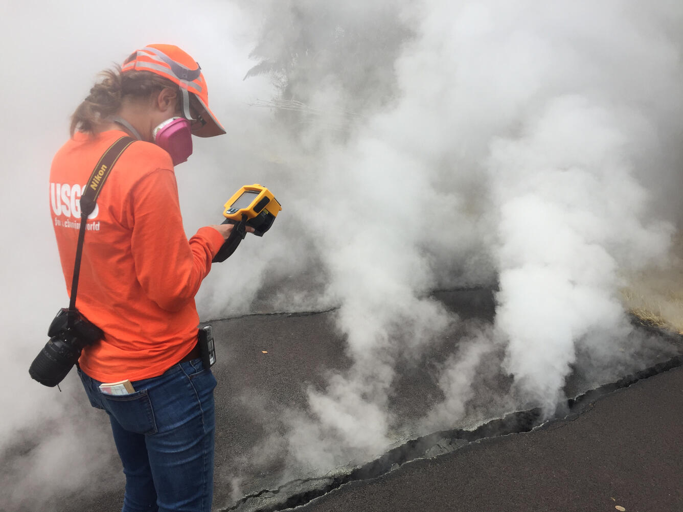
11:47 a.m. HST. Scientist measures the surface temperature of a crack at Nohea Street, Leilani subdivision with a thermal imaging infrared camera. She obtained a reading of 103 centigrade (218 fahrenheit) and noted that the road asphalt was melting.
At 13:00 p.m. HST, a new fissure extended across Pohoiki Road between the intersections of Leilani Avenue, and Hinalo Street. Scientists had difficulty viewing the entire fissure from their location but reported lava spatter five meters high as well as a loud jetting of gas from the fissure.
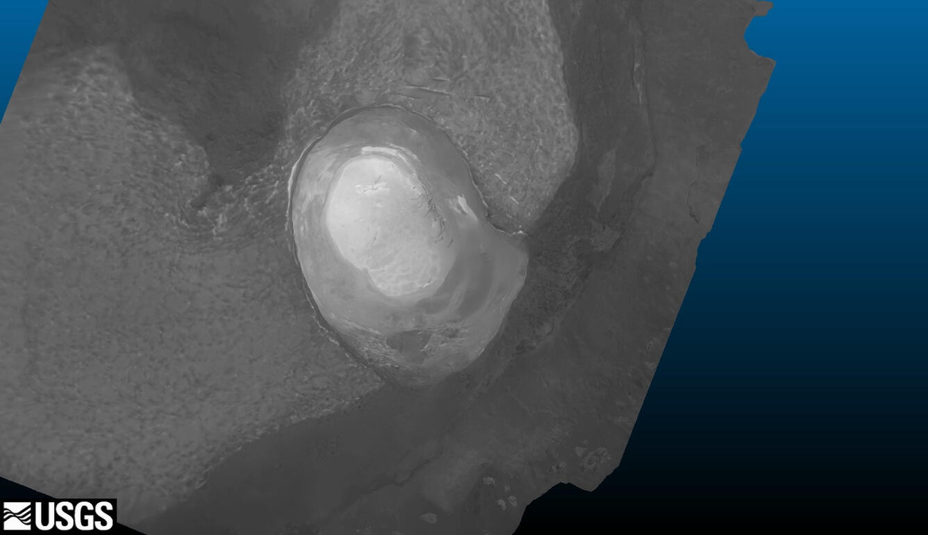
The summit lava lake in Halema‘uma‘u crater has dropped substantially over the past week due to intrusive and eruptive activity on the lower East Rift zone. This 3D model of the crater was created from thermal images collected during a helicopter overflight on May 8. The lake at this time was roughly 295 m (970 feet) below the floor of Halema‘uma‘u Crater.
At 13:00 p.m. HST. Aerial view from the Hawaii County Fire Department of fissure 15. The fissure cut across Pohoiki Road.
At 16:22 HST. Steaming area located uprift (west) of Highway 130. Geologists observed many steaming ground cracks in the area during two overflights this afternoon. This area is inline with fissures 1-15 (in distance, upper left in photo), but located farther west.
Get Our News
These items are in the RSS feed format (Really Simple Syndication) based on categories such as topics, locations, and more. You can install and RSS reader browser extension, software, or use a third-party service to receive immediate news updates depending on the feed that you have added. If you click the feed links below, they may look strange because they are simply XML code. An RSS reader can easily read this code and push out a notification to you when something new is posted to our site.