U.S. flag

An official website of the United States government

November 10, 2021

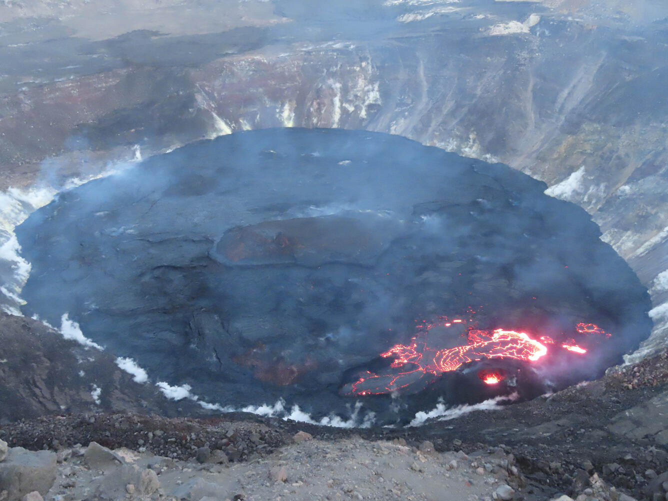
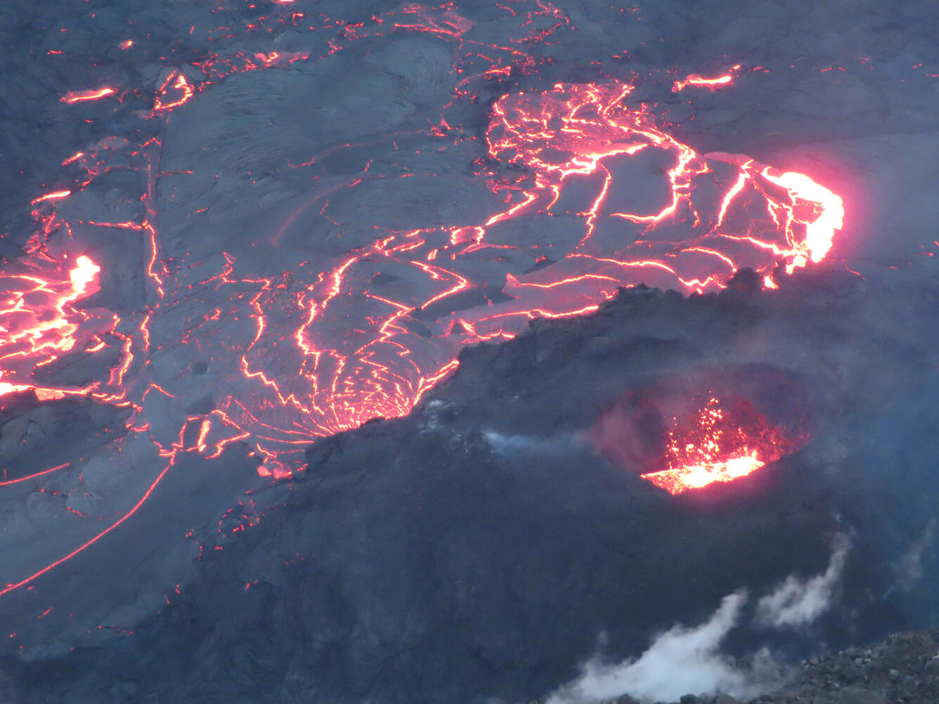
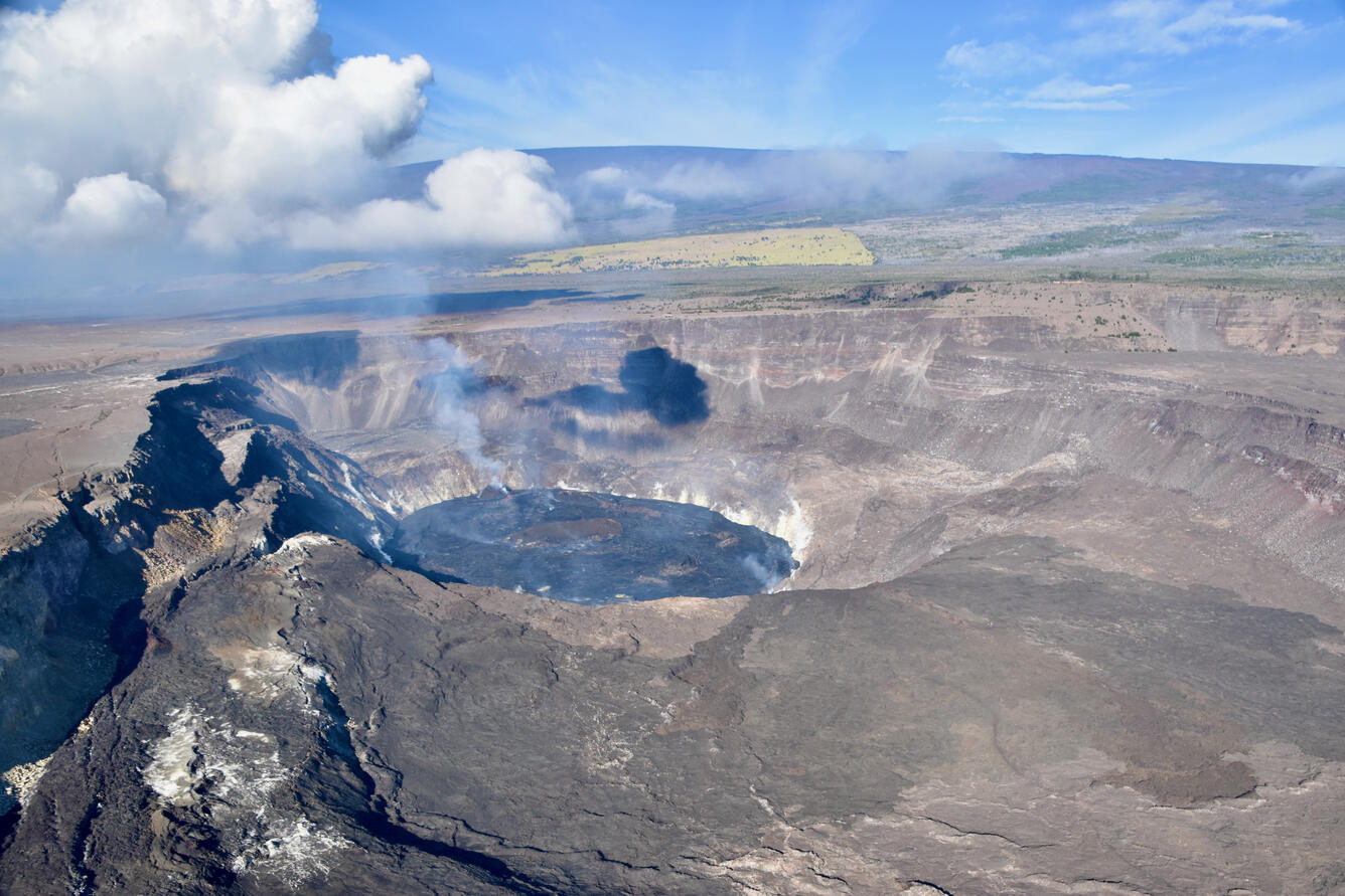
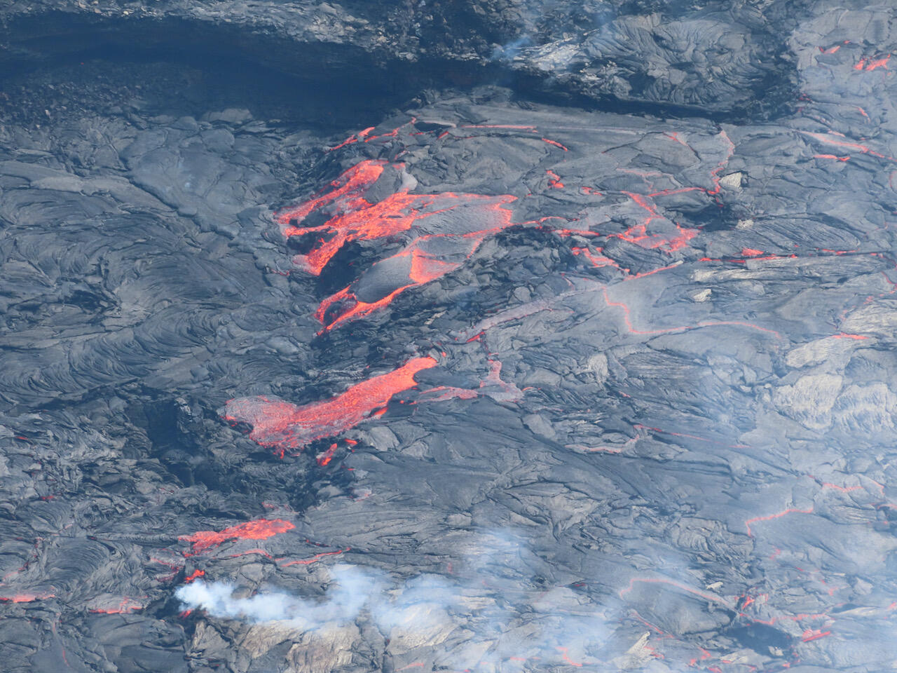
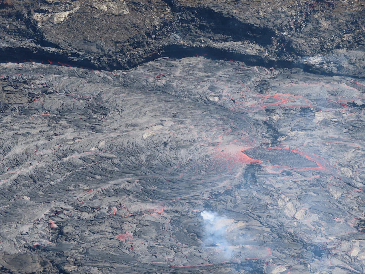
A new eruption at Kīlauea's summit began at approximately 3:20 p.m. HST on September 29, 2021. Lava activity is currently confined within Halema'uma'u crater, in the closed area of Hawai‘i Volcanoes National Park. 

HVO scientists collect detailed data to assess hazards and understand how the eruption is evolving at Kīlauea's summit, all of which are shared with the National Park Service and emergency managers. Access to this hazardous area is by permission from, and in coordination with, Hawai‘i Volcanoes National Park.

Color photograph of active lava lake
The extent of the active lava lake surface (lower right) within Halema‘uma‘u crater, at the summit of Kīlauea, had decreased substantially over the previous day and (at the time of this photo) was limited to the area around the west vent. This photo was taken at 5:48 p.m. HST on November 8, 2021, from the western rim of the crater. USGS photo by J.M. Chang.
color photograph of lava lake and volcanic vent
Despite the temporary decrease in activity at Halema‘uma‘u crater, at the summit of Kīlauea, spattering was still visible within the west vent cone. This telephoto image was taken from the western rim of the crater during a lower level of eruptive activity on November 8, 2021. USGS photo by J.M. Chang.
Color photograph of crater at summit of Kilauea
HVO geologists conducted a helicopter overflight of Halema‘uma‘u, at the summit of Kīlauea, on the morning of November 9. A gas plume can be seen rising from the west vent along the crater wall (center left). Mauna Loa is visible in the background. USGS photo by B. Carr.
color photograph of summit crater and plume
A wide view of the lava lake in Halema‘uma‘u taken during a helicopter overflight on the morning of November 9, 2021. Lava is once again visible in the spillway of the west vent after a brief drop in activity on Monday, November 8. The dark linear feature in the foreground (near center) is a remnant of the April 30, 1982 fissure, which partially collapsed into Halema‘uma‘u during the 2018 summit collapse events. The Southwest Rift Zone of Mauna Loa is visible in the background. USGS photo by L. Gallant.
Color photograph of crater at volcano summit
A view of the Halema‘uma‘u lava lake taken during a helicopter overflight on the morning of November 9, 2021. Lava is visible in the spillway and in the west vent on the far side of the lava lake (center). There are also several small perched overflows in the northwest quadrant of the lake (near center between the vent and main island). USGS photo by L. Gallant.
Color photograph of volcanic vent
A telephoto view of the west vent along the western wall of Halema‘uma‘u crater at the summit of Kīlauea. On November 9, spatter bursts in the west vent cone triggered sloshing on the surface of the ponded lava. Spatter was thrown about 6–9 m (20–30 ft) above the pond surface and occasionally deposited onto the rim of the cone. USGS photo by J. Schmith.
Color photograph of flowing lava
A telephoto view of the western lava lake in Halema‘uma‘u, at the summit of Kīlauea. Around 10:00 a.m. on November 9, geologists in the field witnessed lava from the western part of the active lava lake (right) flowing onto an area of cooled solidified crust (left). The inactive lake surface is about 4 m (13 ft) lower than the active surface of the lake in this area. USGS photo by J. Schmith.
Color photograph of lava lake surface
A telephoto view in the same area of the western lava lake surface within Halema‘uma‘u. Lava continued to flow from the active western lake surface (right) onto the lower area of cooled solidified crust just north of it (left). This photo was taken about an hour after the overflow began, and lava had significantly filled in the low-lying area in this part of the lava lake. USGS photo by J. Schmith.
Color photograph of volcanic plume
On the morning of November 9, a wispy volcanic gas plume (lower left) was visible over Halema‘uma‘u crater, at Kīlauea summit. As the hot plume rose to meet the cool morning air, water vapor formed a cloud above the crater. USGS photo by J. Schmith.
Color photograph of active volcanic vent
During a helicopter overflight of Halema‘uma‘u crater on November 9, HVO geologists observed spattering within the west vent cone and lava entering the lake via a spillway that is now tubed-over. Sulfur dioxide (SO2) emission rates remain elevated with the largest volcanic gas plume coming from the west vent. USGS photo by B. Carr.
color photograph of lava flows
Following a brief—about one day—decrease in activity from November 7–8, the effusion rate within Halema‘uma‘u crater increased again on November 9. The active lava lake surface, which significantly shrunk during the lower-level of activity, has since grown back to it's previous size. This photo shows lava overtopping a small levee on the lake surface that formed as the lake extent retreated last week. USGS photo by B. Carr.
Color photograph of volcanic vent
An aerial telephoto view of the western vent in Halema‘uma‘u crater on the morning of November 9. Spattering at the west vent occasionally reached above the level of the cone rim. The ponded lava within the cone was supplying lava to the lake from a tubed over spillway that is slightly elevated above the lava lake surface. USGS photo taken by B. Carr.

Get Our News

These items are in the RSS feed format (Really Simple Syndication) based on categories such as topics, locations, and more. You can install and RSS reader browser extension, software, or use a third-party service to receive immediate news updates depending on the feed that you have added. If you click the feed links below, they may look strange because they are simply XML code. An RSS reader can easily read this code and push out a notification to you when something new is posted to our site.