
Hot Spots and Cold Snaps
Daily stream temperature data across the U.S. from 1979-2021
Daily stream temperature data across the U.S. from 1979-2021
Elevated geogenic contaminants common in drinking water aquifers across the U.S.
The U.S. is producing more food - without increasing nutrient pollution
National Water Availability data available now through the Data Companion
Explore, download, and use new datasets related to integrated water availability, supply and use.
Explore, download, and use new datasets related to integrated water availability, supply and use.
Water Resources Mission Area
Water information is fundamental to national and local economic well-being, protection of life and property, and effective management of the Nation’s water resources. The USGS works with partners to monitor, assess, conduct targeted research, and deliver information on a wide range of water resources and conditions including streamflow, groundwater, water quality, and water use and availability.
Message from the Associate Director
Message from the Associate Director

Learn more about the Mission Area from the Associate Director for Water Resources.
Water Data for the Nation
Water Data for the Nation

Water data collected at approximately 1.9 million sites across all 50 states.
News
Alaska Park Science: USGS and National Park Service Partners in Research
Alaska Park Science: USGS and National Park Service Partners in Research
New AI Tool Forecasts Drought 90 Days Ahead Nationwide
New AI Tool Forecasts Drought 90 Days Ahead Nationwide
Hot spots and cold snaps: Daily stream temperature data across the U.S. from 1979-2021
Hot spots and cold snaps: Daily stream temperature data across the U.S. from 1979-2021
Publications
Simulated seasonal loads of total nitrogen and total phosphorus by major source from watersheds draining to Washington waters of the Salish Sea, 2005 through 2020 Simulated seasonal loads of total nitrogen and total phosphorus by major source from watersheds draining to Washington waters of the Salish Sea, 2005 through 2020
The U.S. Geological Survey and the Washington State Department of Ecology (Ecology) have developed watershed models of seasonal load estimates of total nitrogen (TN) and total phosphorus (TP) discharging into the Washington State waters of the Salish Sea from 2005 through 2020. The modeling approach used was dynamic SPARROW (SPAtially Referenced Regressions On Watershed attributes), a...
Long-term monotonic trends in water budget components in the contiguous United States: Insights from two hydrologic models Long-term monotonic trends in water budget components in the contiguous United States: Insights from two hydrologic models
Characterizing changes to water availability for domestic, industrial, agricultural, and other uses is essential to support water management. To better quantify these changes, the U.S. Geological Survey and National Science Foundation National Center for Atmospheric Research produced two hydrologic models simulating water budget components from 1980 to 2021 over the contiguous United...
Thickness and other characteristics of overbank sediment deposited during an extreme flood in May 1978 along the Powder River, Montana Thickness and other characteristics of overbank sediment deposited during an extreme flood in May 1978 along the Powder River, Montana
An extreme flood on the Powder River in southeastern Montana in May 1978 inundated its valley and deposited sediment on the floodplains and terraces at multiple heights. The recurrence interval for this flood was less than 1 percent in the reach between Moorhead and Broadus, Montana. Peak discharges at the U.S. Geological Survey streamgages at Moorhead and Broadus were 779 and 711 cubic...
Science

The Rusting of Arctic Rivers: Freshwater Ecosystems Respond to Rapidly Uptaking Metals
The water quality of streams and rivers in the Arctic is sensitive to rapid climate change and altered disturbance regimes.

US Geological Survey/Environment and Climate Change Canada International Gauging Stations
For more than a century, Canada and the United States have maintained a system of monitoring streamflow and water levels for shared waters. Today, the USGS and Environment and Climate Change Canada (ECCC) maintain a network of International Gauging Stations and International Support Gauging Stations that are determined to be mutually beneficial to both agencies.
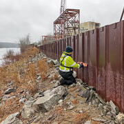
High-Water Marks
High-water marks are like footprints left behind by a flood — they show how high the water reached during a flood event. High-water marks serve as valuable data points for both educational purposes and scientific research, helping us understand past and recent flood events. Collecting this information is an essential and time-sensitive task for understanding flood risk and improving public safety.