The new 3D Hydrography Program (3DHP) is the focus of USGS efforts to acquire and produce detailed surface-water mapping information, such as lakes, ponds, rivers and streams.
Videos
3D Hydrography Program Videos are available below
 Understanding the Transition from NHDPlus HR to 3DHP
The new 3D Hydrography Program (3DHP) is the focus of USGS efforts to acquire and produce detailed surface-water mapping information, such as lakes, ponds, rivers and streams.
 Watershed Boundary Dataset (WBD) Transitioning to 3DHP
The U.S. Geological Survey (USGS) Watershed Boundary Dataset (WBD) is a national hydrologic unit (HU) geospatial dataset that defines surface drainage areas for the United States. This dataset provides a foundation for local, regional, and national applications to manage, archive, exchange, and analyze data by HU.
The U.S. Geological Survey (USGS) Watershed Boundary Dataset (WBD) is a national hydrologic unit (HU) geospatial dataset that defines surface drainage areas for the United States. This dataset provides a foundation for local, regional, and national applications to manage, archive, exchange, and analyze data by HU.
 2024 Overview of the USGS 3D Elevation Program and 3D Hydrography Program for Tribes
USGS invited all federally recognized Tribes, Alaska Native Corporations, and Native Hawaiian Organizations to virtual informational meetings on March 11, 2024 and March 22, 2024 about the 3D National Topography Model and its components, the 3D Elevation Program and the 3D Hydrography Program.
USGS invited all federally recognized Tribes, Alaska Native Corporations, and Native Hawaiian Organizations to virtual informational meetings on March 11, 2024 and March 22, 2024 about the 3D National Topography Model and its components, the 3D Elevation Program and the 3D Hydrography Program.
 Development of a Geographic Information System Methodology for the Public Drinking Water Source Water Assessment Program in Tennessee
Development of a Geographic Information System Methodology for the Public Drinking Water Source Water Assessment Program in Tennessee
linkPresenters are Rebecca Ransom and David Ladd with the USGS Lower Mississippi Gulf Water Science Center in Nashville, TN.
Development of a Geographic Information System Methodology for the Public Drinking Water Source Water Assessment Program in Tennessee
linkPresenters are Rebecca Ransom and David Ladd with the USGS Lower Mississippi Gulf Water Science Center in Nashville, TN.
The US Army Corps of Engineers (USACE) office in Huntington, WV provides a number of floodplain management services. These include base flood elevation (BFE) evaluations, watershed modeling, project planning, and responding to numerous technical questions.
The US Army Corps of Engineers (USACE) office in Huntington, WV provides a number of floodplain management services. These include base flood elevation (BFE) evaluations, watershed modeling, project planning, and responding to numerous technical questions.
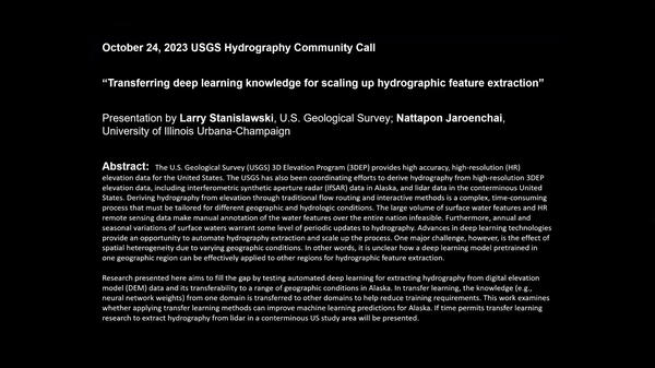
 Transferring Deep Learning Knowledge for Scaling Up Hydrographic Feature Extraction
The U.S. Geological Survey (USGS) 3D Elevation Program (3DEP) provides high accuracy, high-resolution (HR) elevation data for the United States.
The U.S. Geological Survey (USGS) 3D Elevation Program (3DEP) provides high accuracy, high-resolution (HR) elevation data for the United States.
 The 3D Hydrography Program – transition status July 25, 2023
Agenda:
Topic is “The NHD to 3DHP – midyear update”
Agenda:
- 00:00 – Start
- 1:57 - The NHD to 3DHP – midyear update (section1 - Steve Aichele)
- 28:13 - The NHD to 3DHP – midyear update (section2 – Sue Buto)
- 43:05 - Closing remarks
Links:
Topic is “The NHD to 3DHP – midyear update”
Agenda:
- 00:00 – Start
- 1:57 - The NHD to 3DHP – midyear update (section1 - Steve Aichele)
- 28:13 - The NHD to 3DHP – midyear update (section2 – Sue Buto)
- 43:05 - Closing remarks
Links:
 WaterML2 Part 3: Surface Hydrology Features (HY_Features) Conceptual Model and the Mainstems Logistical Data Model
WaterML2 Part 3: Surface Hydrology Features (HY_Features) Conceptual Model and the Mainstems Logistical Data Model
linkHY_Features is the international standard conceptual data model for surface hydrologic features which will be used as the basis for the 3DHP data model – the planned successor to the NHD.
 Governance, Partnerships, and Data Acquisition to Support the 3D Hydrography Program
The U.S. Geological Survey (USGS) has developed a vision for the 3D National Topography Model (3DNTM), which will integrate USGS elevation and hydrography datasets to model the Nation's topography in 3D.
The U.S. Geological Survey (USGS) has developed a vision for the 3D National Topography Model (3DNTM), which will integrate USGS elevation and hydrography datasets to model the Nation's topography in 3D.
The USGS is developing the 3D Hydrography Program (3DHP) as the surface water mapping component of the new 3D National Topography Model (3DNTM.) The 3DHP will provide critical data to support a broad range of national, regional, and local applications such as flood forecasting and response, agricultural planning, infrastructure design, stream ecology research a
The USGS is developing the 3D Hydrography Program (3DHP) as the surface water mapping component of the new 3D National Topography Model (3DNTM.) The 3DHP will provide critical data to support a broad range of national, regional, and local applications such as flood forecasting and response, agricultural planning, infrastructure design, stream ecology research a


