
3D National Topography Model
The 3D National Topography Model (3DNTM) is a new initiative that updates, improves, and integrates USGS elevation and hydrography data to support the most demanding scientific requirements and enable data-driven decisions across user communities.
3D Elevation Program (3DEP)

3D Elevation Program's (3DEP) mission is to respond to growing needs for current high-quality topographic data and for a wide range of other three-dimensional (3D) representations of the Nation's natural and constructed features.
3D Hydrography Program (3DHP)

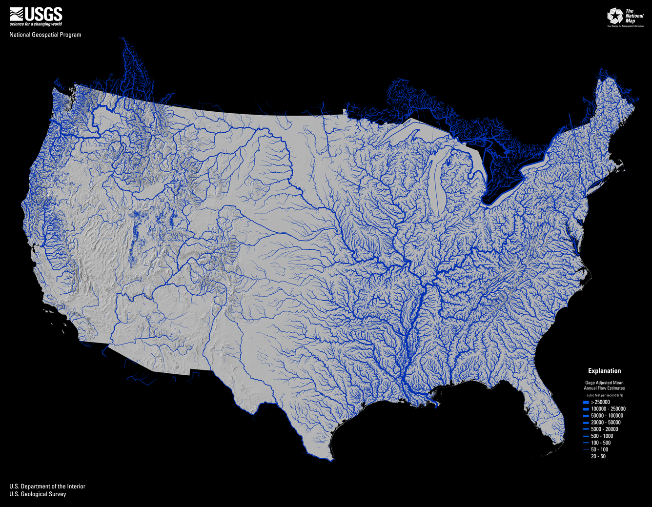
The 3D Hydrography Program's (3DHP) goal is the first systematic remapping of the Nation’s hydrography since the original USGS 1:24,000-scale topographic mapping program was active. Community-wide coordinated investments will contribute toward a consistent set of national water data to answer the most demanding water resource questions.
Data Collaboration Announcement (DCA)

The USGS National Geospatial Program (NGP) collaborates with a wide range of stakeholders to share acquisition costs for topographic data in support of collective mission requirements. Building on the success of the 3DEP Broad Agency Announcement, NGP is changing its data acquisition partnership process beginning in FY 2024 to the Data Collaboration Announcement (DCA).
What is the 3D National Topography Model?
Topography is defined by terrain and water, each influencing and shaping the other. The USGS 3D National Topography Model (3DNTM) initiative embraces this inherent relationship between the Earth’s surface and the water that interacts with it. The 3DNTM updates and integrates USGS elevation and hydrography data to model the Nation in 3D. The 3DNTM is comprised of three components that respond to statutory obligations under the National Landslides Preparedness Act that authorizes 3DEP and the Geospatial Data Act of 2018 directives to 1) collect, maintain, disseminate, and preserve geospatial data such that the resulting data, information, or products can be readily shared with other Federal agencies and non-Federal users; and 2) coordinate and work in partnership with other Federal agencies, agencies of State, tribal, and local governments, institutions of higher education, and the private sector to efficiently and cost-effectively collect, integrate, maintain, disseminate, and preserve geospatial data, building upon existing non-Federal geospatial data to the extent possible.
The 3D Elevation Program (3DEP)
3DEP is on track to complete the first-ever national baseline of consistent, high-resolution 3D elevation data by Fiscal Year 2026 depending on budget and partnerships. The initial 3DEP coverage provides an essential baseline reference that is critical to a broad range of applications. The addition of multiple, higher quality next generation 3DEP acquisitions which began in the last few years builds on the baseline data to significantly expand analysis capabilities and support applications necessary for a more resilient economy, such as flood risk management, infrastructure construction and management, energy development, critical minerals exploration and more. The 3D Nation Elevation Requirements and Benefits Study (3D Nation Study) (NOAA, 2022) conducted jointly by NOAA and the USGS identified potential annual benefits of $7.6 billion U.S. dollars for the next generation of 3DEP.
The 3D Hydrography Program (3DHP)
Building on decades of experience maintaining the portfolio of National Hydrography Datasets, the 3DHP will derive completely new surface water data for the Nation from 3DEP data and will improve discovery and sharing of water-related data. The design of the 3DHP is based on the results of the Hydrography Requirements and Benefits Study that estimated that the fully implemented program would have the potential to provide more than $1 billion in benefits to Federal, State, Tribal, Territorial, and local governments and to private and nonprofit organizations every year, in addition to myriad societal benefits. 3DHP data and capabilities will allow water suppliers to improve water quality and availability, engineers to make better decisions, disaster response planners to better mitigate natural disasters, hydrologists to more fully model the hydrologic cycle, and managers to better develop resources.
Future 3D model
3DNTM includes a vision for a longer-term goal to fully integrate hydrography, elevation, and other data from The National Map in a single 3D data model to enable integrated analysis and interpretation. This component is in the early stages of research and development.


Governance
The 3DNTM effort requires reimagined, integrated governance that includes all aspects of the vision.
The National Landslides Preparedness Act (NLPA) enacted in 2021 establishes the 3DEP Federal Interagency Coordinating Committee (3DE-FICC) to be led by the Department of the Interior. The 3DE-FICC provides direction and oversight to the 3DEP Working Group and the 3DHP Working Group.