Helping the World Through Science
Billions of people live unaware of a far-off USGS facility working every day to improve their lives
USGS Finds New Way to Measure Ocean Depth with Landsat
EROS scientists debut method in publication
Landsat's Exciting Future
Upcoming Landsat Next's trio of satellites will provide more frequent imagery in more detail
Landsat - A Pillar of Land Remote Sensing
Eyes on Earth
Eyes on Earth is a podcast on remote sensing, Earth observation, land change and science, brought to you by the USGS Earth Resources Observation and Science (EROS) Center.
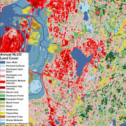
Earth Resources Observation and Science (EROS) Center
At the USGS EROS Center, we study land change and produce land change data products used by researchers, resource managers, and policy makers across the nation and around the world. We also operate the Landsat satellite program with NASA, and maintain the largest civilian collection of images of the Earth’s land surface in existence, including tens of millions of satellite images.
Eyes on Earth

This episode of our remote sensing podcast describes how Landsat is used to map bathymetry in areas that are too difficult to map with lidar or sonar.
Image of the Week

The largest dam removal project in the history of the United States reached a major milestone at the end of August 2024 when crews demolished the last of four dams on the Klamath River, near the California-Oregon border.
EROS Quick Links
Find frequently visited webpages below.
News
New Application Informs Users About Reprocessed Landsat Products
USGS supercomputers help assess volcanic hazards in support of community resilience
End of an era: Historic Landsat 7 mission takes final images
Publications
ECCOE Landsat quarterly Calibration and Validation report—Quarter 1, 2024
Executive Summary The U.S. Geological Survey Earth Resources Observation and Science Calibration and Validation (Cal/Val) Center of Excellence (ECCOE) focuses on improving the accuracy, precision, calibration, and product quality of remote-sensing data, leveraging years of multiscale optical system geometric and radiometric calibration and characterization experience. The ECCOE Landsat Cal/Val Tea