
In late May 2025, Landsat satellites captured imagery of active fires in north-central Saskatchewan, Canada. The fires have caused evacuation orders and closed highways. While the natural color image shows the massive smoke covering the land, false color images allow us to see through the smoke and see the areas of active burning more clearly.
Multimedia
See our Imagery
EROS is home to a wide variety of remotely sensed imagery. Our galleries include some of our best
EROS is home to a wide variety of remotely sensed imagery. Our galleries include some of our best
Before and After
Use our interactive image comparison sliders to see change over time
Use our interactive image comparison sliders to see change over time
Earthshots
See images and read stories about some of the world's most fascinating Earth surface change
See images and read stories about some of the world's most fascinating Earth surface change
We maintain collections of images and videos that are available for download at no charge. Follow the links below to explore our multimedia.
Earth As Art
Earth As Art

In addition to their scientific value, many satellite images are simply intriguing to look at. Satellites capture an incredible variety of views of Earth. See the mesmerizing beauty of river deltas, mountains, and other sandy, salty, and icy landscapes.
Landsat State Mosaics
Landsat State Mosaics

A view of all 50 states from space. The images combine multiple Landsat scenes to showcase each state’s unique landscapes, from expansive forests and arid deserts to bustling cities and serene coastlines.
Landsat in Action
Landsat in Action
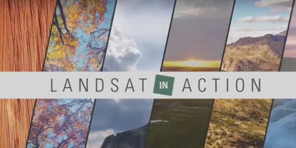
Watch Landsat Science Team members and researchers from around the world talk about the value of remotely sensed imagery to monitoring the health of the planet.
Images

Animation of Landsat images showing fires burning in Saskatchewan, Canada
In late May 2025, Landsat satellites captured imagery of active fires in north-central Saskatchewan, Canada. The fires have caused evacuation orders and closed highways. While the natural color image shows the massive smoke covering the land, false color images allow us to see through the smoke and see the areas of active burning more clearly.

Animation of Landsat images of ships in U.S. harbors
By layering over 10 years of cloud-free Landsat 8 and Landsat 9 images, we can see the bright trails of ship traffic in major U.S. ports and harbors. Check out these striking patterns from popular shipping waterways, captured using Landsat’s panchromatic band. Just another example of how Landsat helps us understand the world from above.
By layering over 10 years of cloud-free Landsat 8 and Landsat 9 images, we can see the bright trails of ship traffic in major U.S. ports and harbors. Check out these striking patterns from popular shipping waterways, captured using Landsat’s panchromatic band. Just another example of how Landsat helps us understand the world from above.

The BigMAC Exercise Site
This picture is the site of the Big Multi-Agency Campaign (BigMAC), a comprehensive field exercise aimed at assessing current technologies that might be used for validation of surface products derived from satellite imagery, The exercise was held in Brookings, South Dakota in August 2021.
This picture is the site of the Big Multi-Agency Campaign (BigMAC), a comprehensive field exercise aimed at assessing current technologies that might be used for validation of surface products derived from satellite imagery, The exercise was held in Brookings, South Dakota in August 2021.

Landsat image displays recent flooding in the Lake Eyre Basin
In April 2025, significant flooding occurred in an area of the Lake Eyre Basin in Southern Australia and Queensland states in Australia.
The Landsat 8 and Landsat 9 satellites both passed over the area and captured the dramatic imagery used in this mosaic of the area.
In April 2025, significant flooding occurred in an area of the Lake Eyre Basin in Southern Australia and Queensland states in Australia.
The Landsat 8 and Landsat 9 satellites both passed over the area and captured the dramatic imagery used in this mosaic of the area.

Landsat's View of the USA image
How does your state use Landsat satellite data? Visit the Landsat’s View of the USA webpage to find how Landsat benefits each of United States. You can download a satellite image, put together an online puzzle, or read a USGS Fact Sheet for your selected state!
How does your state use Landsat satellite data? Visit the Landsat’s View of the USA webpage to find how Landsat benefits each of United States. You can download a satellite image, put together an online puzzle, or read a USGS Fact Sheet for your selected state!

Flooding at the Cullyamurra Waterhole April 2025
In April 2025, the Cullyamurra Waterhole, along the Cooper River in South Australia, reached a water level of 13.39 meters. This surpassed the 1974 record of 11.85 meters.
In April 2025, the Cullyamurra Waterhole, along the Cooper River in South Australia, reached a water level of 13.39 meters. This surpassed the 1974 record of 11.85 meters.
Videos
")
Great Lakes Shipping Season Begins (Image of the Week)
The St. Marys River between Michigan and Ontario is typically frozen January through March. The US Army Corp of Engineers performs maintenance on regulated access channels (the Soo Locks) during the coldest months.
The St. Marys River between Michigan and Ontario is typically frozen January through March. The US Army Corp of Engineers performs maintenance on regulated access channels (the Soo Locks) during the coldest months.

An Introduction to Landsat Data Access and Processing in the Cloud
This video is a recording of a previous webinar entitled: “An Introduction to Landsat Data Access and Processing in the Cloud!.” This webinar was recorded on April 17, 2025.
This video is a recording of a previous webinar entitled: “An Introduction to Landsat Data Access and Processing in the Cloud!.” This webinar was recorded on April 17, 2025.
")
Massive Iceberg on the Loose (Image of the Week)
The world’s largest iceberg floats freely in the Southern Ocean.
Iceberg A23a is a 1,500 square mile ice mass larger than the state of Rhode Island. A23a weighs approximately 1 trillion tons and measures around 1,300 feet thick.
The world’s largest iceberg floats freely in the Southern Ocean.
Iceberg A23a is a 1,500 square mile ice mass larger than the state of Rhode Island. A23a weighs approximately 1 trillion tons and measures around 1,300 feet thick.
")
Landsat's 12 Millionth Image (Image of the Week)
The USGS EROS Landsat archive recently reached a milestone of 12 million Landsat Collection 2 Level-1 products. These are available for download at no charge. The image representing this milestone displays a sprawling desert landscape and contains a multitude of agricultural, geological, and urban features.
The USGS EROS Landsat archive recently reached a milestone of 12 million Landsat Collection 2 Level-1 products. These are available for download at no charge. The image representing this milestone displays a sprawling desert landscape and contains a multitude of agricultural, geological, and urban features.
")
1 HOUR Relaxing Satellite Imagery (Sleep Music, Landsat, Concentrate, Meditation)
Landsat satellites capture images of the Earth’s surface. While the sensors aboard Landsat capture a wide range of scientifically useful wavelengths, this collection reveals natural color imagery in the red, green and blue parts of the visible spectrum, as if viewed by the naked eye from 438 miles above the surface.
Landsat satellites capture images of the Earth’s surface. While the sensors aboard Landsat capture a wide range of scientifically useful wavelengths, this collection reveals natural color imagery in the red, green and blue parts of the visible spectrum, as if viewed by the naked eye from 438 miles above the surface.
")
The Eye of Quebec (Image of the Week)
A large, round lake in Quebec, Canada, highlights the geography of an ancient impact crater.
In the late Triassic Period, a 3 mile wide meteorite struck northern Pangea at over 30,000 miles per hour.
The resulting crater is now 214 million years old, but the dramatic circular lake visible in 2024 Landsat imagery is a surprisingly recent feature.
Audio

Eyes on Earth Episode 135 – Exotic Annual Grasses and Sheep Grazing
Exotic annual grasses, or EAGs, are invasive species. They outcompete native grasses. They are extremely flammable. And they are expanding into higher elevations. Targeted sheep grazing is one way to combat these invasive grasses, manage fire risk, and help restore native sagebrush in western states.
Exotic annual grasses, or EAGs, are invasive species. They outcompete native grasses. They are extremely flammable. And they are expanding into higher elevations. Targeted sheep grazing is one way to combat these invasive grasses, manage fire risk, and help restore native sagebrush in western states.

Eyes on Earth Episode 134 – Data Accuracy: The Calibration and Validation of Landsat
Landsat is the longest-running, continuously operating record of Earth observations, and it’s the gold standard reference point that other civil and commercial satellite programs trust.
Landsat is the longest-running, continuously operating record of Earth observations, and it’s the gold standard reference point that other civil and commercial satellite programs trust.

Eyes on Earth Episode 133 – Vietnam War Bomb Craters
Declassified spy satellite imagery, distributed by the USGS EROS Center, is finding fascinating uses since being made available to the public starting in the 1990s.
Declassified spy satellite imagery, distributed by the USGS EROS Center, is finding fascinating uses since being made available to the public starting in the 1990s.

Eyes on Earth Episode 131 – Using AI in Geospatial Work
Eyes on Earth tackles artificial intelligence (AI) in a 2-part episode. AI is quickly becoming a necessary part of geospatial work at EROS, helping us efficiently do science to better manage our world. In Part 1, EROS Director Pete Doucette discusses AI and its current and upcoming impact on our work at EROS.
Eyes on Earth tackles artificial intelligence (AI) in a 2-part episode. AI is quickly becoming a necessary part of geospatial work at EROS, helping us efficiently do science to better manage our world. In Part 1, EROS Director Pete Doucette discusses AI and its current and upcoming impact on our work at EROS.

Eyes on Earth Episode 132 - Moving Forward with AI at EROS
Eyes on Earth tackles artificial intelligence (AI) in a 2-part episode. AI is quickly becoming a necessary part of geospatial work at EROS, helping us efficiently do science to better manage our world. In Part 1, we talked about AI’s current and upcoming impact on our work at EROS and clarified some of the AI jargon.
Eyes on Earth tackles artificial intelligence (AI) in a 2-part episode. AI is quickly becoming a necessary part of geospatial work at EROS, helping us efficiently do science to better manage our world. In Part 1, we talked about AI’s current and upcoming impact on our work at EROS and clarified some of the AI jargon.

Eyes on Earth Episode 130 – NLCD Accuracy
Every pixel has a story. At least that’s how land remote sensing scientist Jo Horton sees it. The new Annual National Land Cover Database (NLCD) was just released in October 2024. NLCD is widely used for land cover and change research in the U.S.
Every pixel has a story. At least that’s how land remote sensing scientist Jo Horton sees it. The new Annual National Land Cover Database (NLCD) was just released in October 2024. NLCD is widely used for land cover and change research in the U.S.