UAS Survey for Slackwater Harbor Assessment along the Arkansas River
In October 2021 the NUSO, USGS Central Midwest Water Science Center and the U.S. Army Corps of Engineers Little Rock District conducted a light detection and ranging (lidar) topographic and bathymetry survey to support development of a future slackwater harbor along the Arkansas River near Dardanelle, Arkansas.
Evaluation of shoreline stability and the adjacent development of a new harbor along the Arkansas River navigation system at River Mile 202.6 is essential in establishing a baseline for potential impacts and future sediment monitoring. Supporting this evaluation USGS used a combination of multi- and single-beam sonar and high-resolution aerial lidar to provide data for future monitoring, maintenance of the river shoreline, and floodplain management.
USGS collected topographic data in a lidar point cloud (LPC) format using an UAS with a mounted YellowScan Vx20-100 lidar sensor, a system that consists of a lidar scanner and an integrated inertial navigation unit. The UAS followed two perpendicular transects (orientations north-south and east-west) on separate flights while collecting the LPC. The point cloud data was corrected using a post-processed kinematic (PPK) solution with a Trimble R8s base station. A field team surveyed ground control points using Propeller AeroPoint smart targets, PPK corrected to a nearby continuously operated reference station tower. The features of the LPC were attributed to the American Society for Photogrammetry and Remote Sensing point classification standards. The LPC was colorized from a UAS-collected natural color orthoimage using a Ricoh GRII camera.
Use of High-Resolution Topo-Bathymetry to Assess Shoreline Topography and Future Development of a Slackwater Harbor near Dardanelle, Arkansas, October 2021 (USGS Data Release)
Study Points of Contact:
Matt A. Burgess, Ph.D., UAS Operations / Geospatial Analyst
National Uncrewed Systems Office, Geosciences and Environmental Change Science Center
Richard J. Huizinga, Hydrologist
Central Midwest Water Science Center
Radiometric Calibration Comparisons at Table Mountain
The NUSO collaborated with the National Ecological Observatory Network (NEON) in October 2021 to provide coincident data sets for calibration comparisons between airborne remote sensing, UAS remote sensing, and field-based spectral ground truth measurements.
NEON is a national-scale monitoring initiative funded by the National Science Foundation and operated by Battelle. To better understand how U.S. ecosystems are changing, NEON has been designed to collect long-term open access ecological data at diverse sites across the country for 30 years (https://www.neonscience.org/). This includes airborne remote sensing surveys conducted at a subset of sites each year using the NEON Airborne Observation Platform (AOP), Twin Otter aircrafts carrying payloads consisting of three sensor types: high-resolution true color digital camera, imaging spectrometer to capture hyperspectral data with over 400 spectral bands, and discrete and full waveform lidar systems (https://www.neonscience.org/data-collection/airborne-remote-sensing). NEON performs a series of calibration flights before and after each flight season, which typically stretches between March and September to capture the peak greenness of vegetation.
During this mission at the NOAA Table Mountain site just north of Boulder, in between AOP flight lines, NUSO flew two UAS to collect multispectral and hyperspectral data using MicaSense Dual and Resonon Pika-L sensors, respectively. To verify the accuracy of the AOP spectral data, NEON deploys calibration tarps with 3% and 48% reflectance to be mapped during these flights (https://www.neonscience.org/data-collection/imaging-spectrometer). NEON and NUSO scientists collected handheld spectral radiance and reflectance measurements of these tarps, the road, and vegetation using ASD FieldSpec spectroradiometer instruments to calibrate/validate the imagery.
Spectroradiometer Testing and Multispectral Mapping of Invasive Coastal Grasses at Cape Cod, Massachusetts
In collaboration with the Woods Hole Coastal and Marine Science Center Aerial Imaging and Mapping (AIM) team, the NUSO performed a spectroradiometer testing project at Cape Cod, Massachusetts in October of 2021. The primary goal of this effort was to improve ground truthing capabilities to calibrate and validate UAS-collected multispectral and hyperspectral data for coastal natural hazard and invasive species mapping applications.
This UAS mission was conducted to collect multispectral imagery coincident with field-based spectral measurements at the Sage Lot marsh on Cape Cod, a site that contains an invasive grass species (Phragmites) which USGS scientists want to detect in coastal environments. There is evidence for invasives as a result of natural hazards. These flights also served to help keep USGS pilots proficient and prepared to fly during emergencies. The AIM team conducted the UAS flight with a 3DR Solo quadcopter carrying a MicaSense RedEdge 5-band multispectral camera. NUSO and AIM researchers operated field spectrometers to collect spectral reflectance measurements within a four-hour window of the UAS overflight. Two handheld spectroradiometers were used to collect data for comparison: the industry standard (ASD FieldSpec 4) and a potential cost-saving alternative (Ocean Insight HDX).
Study Points of Contact:
Victoria Scholl, Physical Scientist
National Uncrewed Systems Office, Geosciences and Environmental Change Science Center
Jennifer Cramer, Geographer
Woods Hole Coastal and Marine Science Center
Alexandra Evans, Postdoc Investigator
Woods Hole Oceanographic Institution
3D Modeling of a Vertical Canyon Feature at the Cimarron Canyon
NUSO researchers worked with USGS geologists in September 2021 to establish and test unique photogrammetric data collection techniques utilizing UAS along the Paleocene Poison Canyon Formation in the Cimarron Canyon.
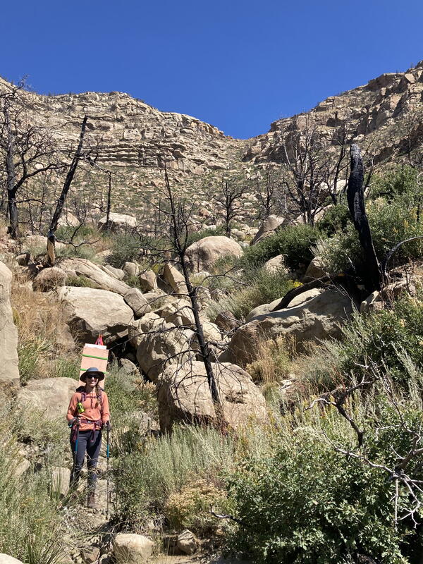
The outcrops exposed along Cimarron Canyon are of the Paleocene Poison Canyon Formation, a geological unit that represents an uplift of the adjacent Sangre de Cristo Mountains. This area contains a complex geologic history of sedimentary layering of ancient river deposits. The high-resolution geologic mapping of Cimarron Canyon is currently ongoing by USGS Geologists. The goal of this mission was to evaluate UAS as a way for USGS Geologists to safely measure stratigraphic layers on vertical rock faces in areas inaccessible by traditional on-foot surveys.
Due to the complex nature of mapping vertical faces, the NUSO approached this photogrammetric data collection using a few unique techniques. Overlapping photos were collected using a Sony A7r camera with a locked focus using a 14mm wide-angle lens. The mapping payload consists of a stabilized gimbal with vibration dampening. The gimbal also allows the team to collect a complex series of images (with ideal geometry) from various angles around the outcrops. The gimbal stabilization allowed scientists to push smaller lens apertures, achieving a sharply focused set of overlapping images covering a considerable depth-of-field. After acquiring the data utilizing these photogrammetric collection techniques a 3D model of the vertical face was generated.
Study Point of Contact:
Theresa M. Schwartz, Research Geologist
Geosciences and Environmental Change Science Center
Particle Sampling at a Grassland Burning in the Konza Prairie Biological Station
In April and September of 2021, NUSO scientists supported wildfire smoke emission research by the Environmental Protection Agency (EPA) and USGS Columbia Environmental Research Center, by flying a gas and particle sampling payload during the annual grassland burns at Konza Prairie Biological Station in the Flint Hills grasslands of Kansas.
A helium balloon has been used to carry emission samplers such as the Kolibri in the past, but it required operators to be much closer to the fire and isn’t as straightforward to maintain a consistent sensor position within the shifting smoke column. Therefore, it was believed that UAS technology was well-suited for this mission since it could be easily positioned to hover at fixed flight altitudes within the smoke column. As a result, EPA researchers are developing the Kolibri system, an air emission sampler instrument for use on an UAS.
Learn more about the EPA Kolibri gas sampler
Study Points of Contact:
Joe Adams, IT Specialist and Remote Pilot
National Uncrewed Systems Office, Geosciences and Environmental Change Science Center
Brian Gullet
Environmental Protection Agency (EPA) Office of Research and Development
Matthew Struckhoff, Ecologist
Columbia Environmental Research Center
Mapping Harmful Algal Blooms at the North Santiam River
The USGS Oregon Water Science Center teamed up with the NUSO in August 2021 to explore bathymetric and remote sensing techniques to detect periphyton, a complex mixture of algae, cyanobacteria, and microbes in freshwater ecosystems.
Accurate mapping of these harmful algal blooms (HABs), persistent environmental hazards that can sicken or kill people and animals, is becoming increasingly important. NUSO researchers collected RGB imagery and tested a Headwall Nano hyperspectral sensor during UAS flights at the Fishermen’s Bend Recreation Area in Mill City, Oregon. Field measurements were also collected during the flights to help relate the remotely sensed images to algae presence in the North Santiam River and above- and below- water spectra and photos were collected to capture periphyton conditions. Spectral ground truth measurements of calibration tarps and a white reference panel were also collected to support image calibration.
Study Point of Contact:
Brandon Overstreet, Hydrologist
Oregon Water Science Center
Post-Wildfire Mapping of Colorado's East Troublesome Fire Burn Area
The DOI Office of Wildland Fire (OWF), in partnership with the NUSO, in June 2021 conducted evaluations to determine best practices and methodology for data collection of post-fire events utilizing UAS.
Previous research efforts have successfully utilized UAS technology to estimate canopy characteristics, interpret fuel model types, and calculate fire behavior. This project aims to extend previous research into more complex vegetation/fuel types within a post-catastrophic fire component. Three sample areas exhibiting various levels of fire intensity and fuel types were chosen within the 2020 East Troublesome burn perimeter located near Granby, Colorado. This study collected centimeter-level UAS multispectral (10-band) and natural color (RGB) imagery, processed using Structure-from-Motion (SfM) techniques. In addition to the imagery, centimeter-level lidar point clouds were acquired using UAS to estimate vegetation/fuels characteristics such as Canopy Cover, Canopy Height, Canopy Base Height, and Canopy Bulk Density.
The DOI OWF and the USGS desire to implement optimum data gathering and processing techniques to create best practices applying UAS technology into the DOI fuels and BAER programs. This project explores mapping processes that could display contact zones between fire intensity and burn severity. Fire Science is fundamental to understanding the causes, consequences, and benefits of wildfire and helps prevent and manage significant, catastrophic events.
Study Point of Contact:
Craig Thompson, Geospatial Data Analyst
DOI Office of Wildland Fire
Multiscale Spectroscopy of Intertidal Biofilm at the San Francisco Bay
In a partnership with the USGS Western Ecological Research Center, the USGS Western Geographic Science Center, the USGS Spectroscopy Lab, and California State University Monterey Bay, the NUSO in May of 2021 collected true-color, multispectral, and hyperspectral UAS data as part of a multi-scale spectroscopy project to map intertidal mudflat biofilms in San Francisco Bay.
Intertidal biofilm (a slimy green layer of fungi and bacteria growing on top of mud) inhabits mudflats and is an essential component of shorebirds’ diets in San Francisco Bay, CA. Scientists at the USGS Western Ecological Research Center (WERC) are leading a project to study the quantity and composition of biofilm to inform wetland restoration and resulting habitat quality in this ecosystem.
The NUSO collected true-color, multispectral, and 4cm spatial resolution hyperspectral imagery using a Resonon Pika L visible and near-infrared (VNIR) UAS camera. The UAS data provides an intermediate perspective between a ground-based field spectrometer, HySpex VNIR/Short-wave infrared imaging spectrometer mounted in a tripod (5 mm resolution), and the AVIRIS-NG airborne imaging spectrometer (4 m resolution).
This work is part of a larger WERC-led project on "Quantifying Drivers and Stressors of Intertidal Biofilm Resources at the Largest Tidal Wetland Restoration on the U.S. West Coast". Results will support managers' need to measure and visualize habitat quality for shorebirds and understand the influence of wetland restoration activities on biofilm resources (Kristin Byrd, USGS, DOI Highlight).
Study Points of Contact:
Joe Adams, IT Specialist and Remote Pilot
National Uncrewed Systems Office, Geosciences and Environmental Change Science Center
Susan de la Cruz, Research Wildlife Biologist
Western Ecological Research Center
Kristin Byrd, Research Physical Scientist
Western Geographic Science Center
Raymond Kokaly, Spectroscopy Expert / Research Geophysicist
Geology, Geophysics, and Geochemistry Science Center
Missouri River Dye Study
The NUSO, Columbia Environmental Research Center, U.S. Army Corps of Engineers, and Missouri University of Science and Technology researchers conducted a Missouri River dye-trace assessment in May 2021 to support natural hazards research of high river flow events and associated effects on endangered species.
Red dye was released upstream while a team of scientists on the ground and in boats on the river recorded dye concentration, depth, velocity measurements with traditional flow meters and spectral measurements of the water surface. The non-toxic dye used in the Missouri River experiment had a very visible red color that dissipated as the water flowed downstream. A crewed aircraft flew overhead at 3,500 ft collecting aerial imagery while NUSO researchers used the Parrot Anafi UAS to collect video along the river from bank to bank to support water velocity and flow monitoring.
Study Point of Contact:
Robert Jacobson, Supervisory Research Hydrologist
Columbia Environmental Research Center