
Looking southwest from Military Crossing Road with Mt. Scott in the background. The Williamson River makes its way through dense marsh vegetation.
Images
Check out photos of some of the awesome work USGS scientists and field technicians have done over the years.
Filter Total Items: 212

Klamath Marsh, Oregon
Looking southwest from Military Crossing Road with Mt. Scott in the background. The Williamson River makes its way through dense marsh vegetation.

The Klamath Marsh
Looking southwest from Silver Lake Rd. towards Wocus Bay in the Klamath Marsh. The upper reaches of the Williamson River winds through the marshland.
Looking southwest from Silver Lake Rd. towards Wocus Bay in the Klamath Marsh. The upper reaches of the Williamson River winds through the marshland.

Williamson River in the Klamath Marsh
Looking northwest from Military Crossing Rd with the Williamson River in the foreground.
Looking northwest from Military Crossing Rd with the Williamson River in the foreground.

Groundwater irrigation well
A groundwater irrigation well supplies water to a small channel in southern Oregon.
A groundwater irrigation well supplies water to a small channel in southern Oregon.


Gate Creek at Vida, OR - 14163000
The brown PVC bank mounted pipe houses water-quality instruments. The grey cylinder houses an automatic sampler, that draws water samples from the river at programed times.
The brown PVC bank mounted pipe houses water-quality instruments. The grey cylinder houses an automatic sampler, that draws water samples from the river at programed times.

Childrens Clean Water Festival
Lisa Hoaks and Carrie Boudreau ran an exhibit booth at the 2024 Children's Clean Water Festival. They presented an introduction to the Water Cycle with an interactive matching game along with a look at the USGS Streamer app to see where nearby rivers flow.
Lisa Hoaks and Carrie Boudreau ran an exhibit booth at the 2024 Children's Clean Water Festival. They presented an introduction to the Water Cycle with an interactive matching game along with a look at the USGS Streamer app to see where nearby rivers flow.

Children's Clean Water Festival
Lisa Hoaks and Carrie Boudreau ran an exhibit booth at the 2024 Children's Clean Water Festival. They presented an introduction to the Water Cycle with an interactive matching game along with a look at the USGS Streamer app to see where nearby rivers flow.
Lisa Hoaks and Carrie Boudreau ran an exhibit booth at the 2024 Children's Clean Water Festival. They presented an introduction to the Water Cycle with an interactive matching game along with a look at the USGS Streamer app to see where nearby rivers flow.

Boating on the Columbia River
Scientist's boat on the Columbia River collecting samples to help track toxins throughout the year.
Scientist's boat on the Columbia River collecting samples to help track toxins throughout the year.

Passive sampler retrieval
Retrieving a Solid Phase Adsorption Toxin Tracking (SPATT) sampler from the Columbia River. Passive samplers like this one are left in the river to accumulate toxins over time for later analysis.
Retrieving a Solid Phase Adsorption Toxin Tracking (SPATT) sampler from the Columbia River. Passive samplers like this one are left in the river to accumulate toxins over time for later analysis.

Columbia River
The USGS monitors for toxins near the industrial complexes of the Columbia River in Portland. Learn more about Portland's industrial areas.
The USGS monitors for toxins near the industrial complexes of the Columbia River in Portland. Learn more about Portland's industrial areas.

Detroit Lake water-quality pontoon platform monitoring station
Technicians deployed Detroit Lake's new water-quality monitoring station in April, 2024.
Technicians deployed Detroit Lake's new water-quality monitoring station in April, 2024.

Umatilla River Basin
The Umatilla River basin in northeastern Oregon is characterized by warm, dry summers and cold, wet winters. Photo taken during groundwater recharge research field work.
The Umatilla River basin in northeastern Oregon is characterized by warm, dry summers and cold, wet winters. Photo taken during groundwater recharge research field work.

Well water samples in the Umatilla River Basin
Scientist collects well water sample to test for isotopic age tracers. Well locations represent different flow paths in the aquifer system.
Scientist collects well water sample to test for isotopic age tracers. Well locations represent different flow paths in the aquifer system.
Maintenance at Detroit Lake's water-quality profiler
Scientists take reference check readings from freshly calibrated sensors to ensure accuracy of deployed instruments.
Scientists take reference check readings from freshly calibrated sensors to ensure accuracy of deployed instruments.

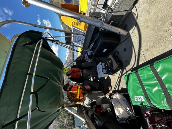
Setting up the ADCP
Hydro tech Josh Price guides training participants as they set up the software that interfaces with the acoustic measurement equipment. Photo by Brandon McMullen.
Hydro tech Josh Price guides training participants as they set up the software that interfaces with the acoustic measurement equipment. Photo by Brandon McMullen.

Measuring the Donner und Blitzen River at Malheur National Wildlife Refuge
The Donner und Blitzen River flows north through the Malheur National Wildlife Refuge into Malheur Lake. Photo by Brandon McMullen.
The Donner und Blitzen River flows north through the Malheur National Wildlife Refuge into Malheur Lake. Photo by Brandon McMullen.

ADCP Measurement training at Malheur National Wildlife Refuge.
USGS Oregon Water Science Center instructors prep Malheur National Wildlife Refuge & High Desert Partnership staff to collect streamflow measurements with an acoustic instrument (ADCP). This training will empower them to collect important data for decision-making for years to come. Photo by Brandon McMullen.
USGS Oregon Water Science Center instructors prep Malheur National Wildlife Refuge & High Desert Partnership staff to collect streamflow measurements with an acoustic instrument (ADCP). This training will empower them to collect important data for decision-making for years to come. Photo by Brandon McMullen.

USGS streamflow measurement training at Malheur National Wildlife Refuge
Participants from the Malheur National Wildlife Refuge and High Desert Partnership gathered for a USGS lead streamflow measurement training using acoustic technology. Photo by Jeremiah Drewel.
Participants from the Malheur National Wildlife Refuge and High Desert Partnership gathered for a USGS lead streamflow measurement training using acoustic technology. Photo by Jeremiah Drewel.