U.S. Fish & Wildlife Service - Automated Waterfowl Counts
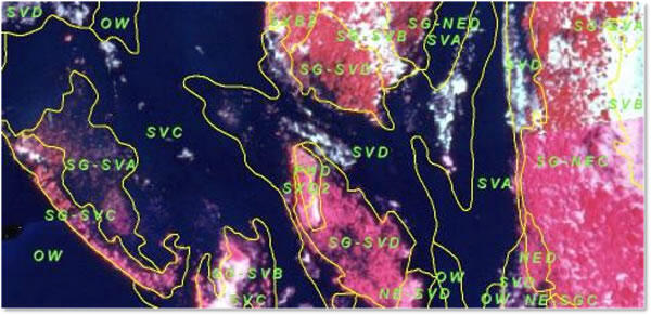
The Upper Mississippi River System (UMRS) is an important stopover point for waterfowl during early-spring and late-fall migrations, particularly portions of the river between the Navigation Pools 4 and 13.This part of the Upper Mississippi River contains large areas of aquatic vegetation that include preferred food sources such as Arrowhead and Wild Celery. In addition, many of these areas are closed to hunting and posted as voluntary avoidance zones, allowing waterfowl to feed and rest undisturbed before continuing their journey.
Once images are georeferenced and mosaicked into single images of study sites, image processing software is used to perform a threshold adjustment on the image.This threshold adjustment takes each pixel value and recolors it either black or white, depending on the value selected. As in the example shown below, a threshold of 185 will turn all pixel values of 185 or less to white and pixels greater than 185 to black. A threshold setting is chosen that emphasizes waterfowl, turning waterfowl pixels white and allowing other parts of the image to turn black. This image is saved as a 1-bit black-and-white image. Some editing of other light areas may be necessary to ensure that only waterfowl are being assessed.
Object-based feature recognition software, such as the ArcMap extension Feature Analyst, can manipulate these images further and be programmed to place a single point in the center of each block of white pixels. These points are edited once more to ensure that only waterfowl are represented, resulting in a layer of points documenting each waterfowl’s location on the earth at the time the image was taken. The points can also overlay images from earlier dates as well as additional GIS layers such as water depth, flow velocities, or vegetation to develop a better understanding of the needs of migrating waterfowl. Examples of this process are shown in the images below, including an animation of swan use for a study site in lower Pool 8 during the fall 2004 migration.
Related studies are currently in progress to assess digital imagery’s ability to distinguish between different waterfowl species when collected at very high resolutions (between 1” and 4”/pixel).
Impact of UMESC Science
Determination of preferred habitat locations and intensity of use allows resource managers to better understand the needs of migrating waterfowl.


Below are partners associated with this project.
The Upper Mississippi River System (UMRS) is an important stopover point for waterfowl during early-spring and late-fall migrations, particularly portions of the river between the Navigation Pools 4 and 13.This part of the Upper Mississippi River contains large areas of aquatic vegetation that include preferred food sources such as Arrowhead and Wild Celery. In addition, many of these areas are closed to hunting and posted as voluntary avoidance zones, allowing waterfowl to feed and rest undisturbed before continuing their journey.
Once images are georeferenced and mosaicked into single images of study sites, image processing software is used to perform a threshold adjustment on the image.This threshold adjustment takes each pixel value and recolors it either black or white, depending on the value selected. As in the example shown below, a threshold of 185 will turn all pixel values of 185 or less to white and pixels greater than 185 to black. A threshold setting is chosen that emphasizes waterfowl, turning waterfowl pixels white and allowing other parts of the image to turn black. This image is saved as a 1-bit black-and-white image. Some editing of other light areas may be necessary to ensure that only waterfowl are being assessed.
Object-based feature recognition software, such as the ArcMap extension Feature Analyst, can manipulate these images further and be programmed to place a single point in the center of each block of white pixels. These points are edited once more to ensure that only waterfowl are represented, resulting in a layer of points documenting each waterfowl’s location on the earth at the time the image was taken. The points can also overlay images from earlier dates as well as additional GIS layers such as water depth, flow velocities, or vegetation to develop a better understanding of the needs of migrating waterfowl. Examples of this process are shown in the images below, including an animation of swan use for a study site in lower Pool 8 during the fall 2004 migration.
Related studies are currently in progress to assess digital imagery’s ability to distinguish between different waterfowl species when collected at very high resolutions (between 1” and 4”/pixel).
Impact of UMESC Science
Determination of preferred habitat locations and intensity of use allows resource managers to better understand the needs of migrating waterfowl.


Below are partners associated with this project.

