
USGS Researchers Invite Community Members to Help Kick Off a New Study of Local Streams and Conservation Practices in the Shenandoah Valley
The U.S. Geological Survey (USGS) had begun working with local farmers, resource managers, and educators in the War Branch watershed, making it as a place where community members can learn about local stream health and conservation practices. Data collected in War Branch could help researchers understand the effectiveness of conservation practices.
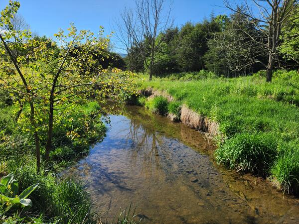
In the Shenandoah Valley, just north of Harrisonburg, a small creek winds through the farm fields and pastures of Rockingham County. This is War Branch, a tributary of Smith Creek and the North Fork of the Shenandoah River. Although it may look like any other creek, War Branch is something special.
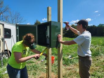
War Branch, and the broader Smith Creek watershed, are areas where many farmers are actively engaged in various conservation efforts. Many of the farmers living and working in the War Branch watershed have volunteered to use conservation practices on their land. Conservation practices are actions many farmers are taking to control erosion, reduce nutrient pollution, and promote soil health, such as planting cover crops, using nutrient management plans, or putting up fencing to keep livestock out of streams. Based on feedback from local partners and conservation groups throughout Virginia, the USGS installed a water-quality monitoring station on War Branch in May of 2024. Data collected from this station could help show the water-quality effects of these conservation practices used throughout the watershed.
Water-quality data collected from War Branch, like all USGS data, are in the public domain and free to use. For this monitoring station, however, the USGS plans to do more than just collect data. The USGS has begun working with local farmers, resource managers, and educators to use War Branch as a place where people can learn about local stream health and conservation practices. Some local schools and universities already have expressed interest in bringing students out to War Branch, where they can both figuratively and literally get their feet wet and learn more about their local streams. Jimmy Webber, a Hydrologist with the USGS who has led water-quality research in the Smith Creek watershed for years, hopes that anyone who is interested in learning more about the work going on at War Branch, including educational and community outreach opportunities, will reach out to him and his team.
“We want War Branch to be an outdoor classroom for students, conservationists, and farmers. The data we’re collecting here can be used to understand local stream conditions and may motivate additional conservation work throughout the watershed”.
-Jimmy Webber, USGS
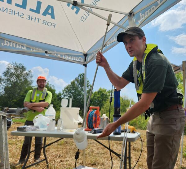
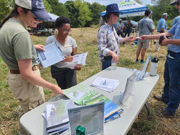
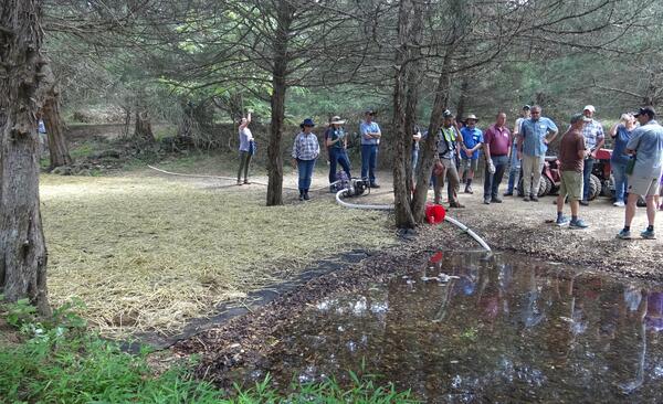
The USGS and local partners hosted a meeting at the new War Branch monitoring station on August 27th to share water-quality and conservation work happening in the watershed. About 40 people attended the meeting, including farmers, environmental and agricultural agencies, nonprofit groups, and local universities.
Webber and other USGS researchers demonstrated how water quality is measured at War Branch and other monitoring stations. From hi-tech devices that instantly detect changing stream conditions to simple weighted bottles used to collect samples to be analyzed in a laboratory, USGS staff shared the methods used to collect the data on which so many local partners rely.
Meeting attendees also toured a bioreactor that recently was installed on a nearby spring that flows into War Branch. The USGS previously has measured elevated nitrate concentrations from this spring, one of the nutrients that some conservation practices, such as bioreactors, aim to reduce. At first glance, the bioreactor doesn’t look all that impressive. It is an area where spring flow has been dammed up, filled with woodchips, and covered with soil. While its design may be simple, the wetted woodchips create an environment for bacteria that remove nitrate from the water as it passes through the bioreactor.
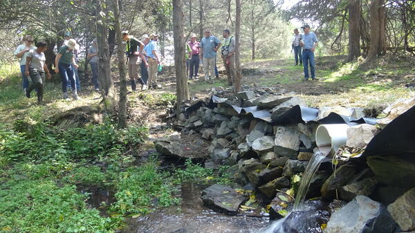
“Bioreactors are effective at removing nitrate from water” explained Spencer Tassone, a USGS researcher working in War Branch. Tassone and his USGS colleagues are hopeful that water-quality benefits of the bioreactor and other conservation practices may be seen at the War Branch monitoring station.
Webber, Tassone, and other USGS researchers working in War Branch are eager for more people to become involved with their work. Anyone interested in learning more about the work going on at War Branch, including educational and community outreach opportunities, is encouraged to reach out to Jimmy Webber and Spencer Tassone.
War Branch is one of five small agricultural watersheds that the USGS monitors throughout the Chesapeake Bay watershed. You can learn more about War Branch and these other watersheds at the USGS Small Agricultural Watershed Monitoring project webpage.
Related

Monitoring the Effectiveness of Conservation Practices in Small Agricultural Watersheds
Related
Monitoring the Effectiveness of Conservation Practices in Small Agricultural Watersheds
Get Our News
These items are in the RSS feed format (Really Simple Syndication) based on categories such as topics, locations, and more. You can install and RSS reader browser extension, software, or use a third-party service to receive immediate news updates depending on the feed that you have added. If you click the feed links below, they may look strange because they are simply XML code. An RSS reader can easily read this code and push out a notification to you when something new is posted to our site.