
The United States Geological Survey (USGS) Earth Resources Observation and Science (EROS) Center maintains one of the largest civilian collection of images of the Earth’s land surface. At EROS, we study land change and produce land change data products used by researchers, resource managers, and policymakers across the nation and around the world.
Landsat Data Access
In 2008, the Landsat products stored in the USGS EROS archive became available for download at no cost to users. The applications described below allow access to the Landsat products from the USGS archive. Each application provides unique capabilities that may be useful to user preferences, as either single file or large quantity (bulk) downloads.
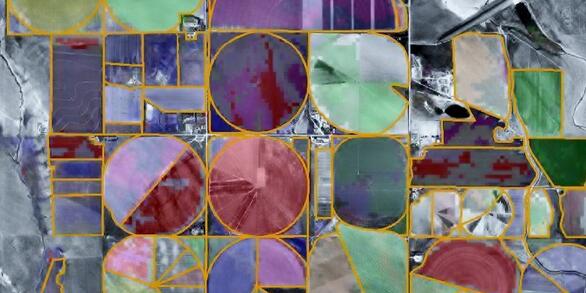
USGS EarthExplorer
USGS EarthExplorer

EarthExplorer's graphical interface lets you define areas of interest by using the map to create points or polygon selections, entering an address, zip code or place name, set a date range, and search multiple datasets simultaneously. More than 120 datasets from a wide range of satellite, aerial, land cover, and elevation sources are available to search.
Landsat in the Cloud
Landsat in the Cloud

Besides downloads from traditional data portals, Landsat Collection 2 operational products can be accessed from the Amazon Web Services (AWS) cloud platform. Leveraging the data storage and processing capabilities that cloud services provide offers new ways to explore the growing record of Landsat observations.
USGS ESPA
USGS ESPA
The EROS Science Processing Architecture (ESPA) On-Demand Interface enables users to request spectral indices like NDVI, SAVI, and more. Users can also request provisional higher-level products, such as Aquatic Reflectance and Actual Evapotranspiration. ESPA provides access to Bulk API and Downloader applications for streamlined data retrieval.
Please refer to each application's Help or User Guide for use and best practices.
USGS Supported Applications
EarthExplorer
https://earthexplorer.usgs.gov
EarthExplorer (EE) is a graphical interface that can be used to define areas of interest by selecting an area on the map, or entering an address, zip code, or by place name.
Searches can be applied to multiple datasets simultaneously, and a footprint or browse image of each result can be displayed on the map. Landsat Level-1 browse images can be viewed in a variety of band combinations to help determine which scene would be the best in the research being conducted.
The following Landsat Collection 2 products can be searched and downloaded from EE:
- Landsat Level-1 scene based products (Landsat 1-9, worldwide)
- Landsat Level-2 scene based surface reflectance and surface temperature products (Landsat 4-9, worldwide)
- Landsat U.S. Analysis Ready Data (ARD) tiled products (Landsat 4-9, Conterminous U.S., Alaska, Hawaii)
- Landsat Level-3 tiled science products (Landsat 4-9, Conterminous U.S., Alaska, Hawaii)
- Burned Area, Dynamic Surface Water Extent, Fractional Snow Covered Area, Fractional Snow Covered Area Statistics
- Landsat Collection 2 Digital Elevation Model (DEM) products (Landsat 1-9, worldwide)
Details about the Landsat products listed here can be found by accessing the Landsat Product Information webpage.
All Landsat Collection 2 operational data can be accessed from an Amazon Web Services (AWS) cloud platform. Leveraging the data storage and processing capabilities that cloud services provide offers new ways to explore the growing record of Landsat observations. All Landsat data stored in the AWS cloud platform include SpatioTemporal Asset Catalog (STAC) metadata.
Visit the Landsat Commercial Cloud Data Access webpage to learn more about STAC and using Landsat data in the cloud environment. A number of tutorials are also available to help users Access and Process Landsat data in the cloud.
The BDWA Uses a file system access API directly within Chrome or Edge browsers to quickly download selected files to the user's system. The BDWA becomes available when the appropriate icon is selected in the EarthExplorer Results section. Refer to the documentation to ensure proper set up and optimal access. All operational Landsat products displayed in EarthExplorer can be downloaded using the BDWA.
A number of tutorials are available to help users learn more about using the BDWA.
The M2M utilizes a RESTful JSON API for accessing datasets and provides the same options and functions as EarthExplorer. All interaction with this service follows JSON specifications and uses the 'application/json' content type. Visit the webpage for documentation and scripting examples. All operational Landsat products displayed in EarthExplorer can be downloaded using the BDWA.
The XML and CSV files on the Landsat Bulk Metadata Service webpage contain metadata for the complete inventory of Landsat Level-1, Landsat Level-2, and U.S. Landsat ARD holdings in the USGS EROS archive. The files are quite large, are updated with new information each day, and are best accessed via script functions.
GloVis provides access to Landsat Collection 2 Level-1 scene-based products held in the USGS EROS archive.
The ESPA on Demand Interface accepts processing requests for Landsat Provisional Aquatic Reflectance and Actual Evapotranspiration higher level products, as well as Landsat Spectral Indices. Customization services are also available from ESPA
NASA Application for Extracting and Exploring Analysis Ready Samples (AρρEEARS)
AρρEEARS lets you access and transform geospatial data from a variety of federal data archives, including Landsat U.S. Analysis Ready Data (ARD) tiled products.
Landsat Visualization Tools
The following applications listed below provide Landsat viewers; however, the USGS has no authority over the products or services provided by these applications. Consult the user help information for each application to learn more.
Sentinel Hub EO Browser
The Sentinel Hub EO Browser makes it possible to browse and compare full resolution images from many satellite collections, including Landsat Level-1 and Level-2 products.
Esri Landsat Explorer
Esri Landsat Explorer is an interactive tool that leverages a variety of ArcGIS capabilities to explore Landsat Collection 2 Level-2 imagery.
Disclaimer: This web page contains hypertext links to information created and maintained by other organizations. USGS is not responsible for the content of any off-site pages. Reference herein to any specific commercial products, processes, or services by trade name, trademark, manufacturer, or otherwise, does not constitute or imply its endorsement or recommendation by the United States Government.
Interesting Landsat Distribution Information
Check out the links below to view interesting charts and graphs about the Landsat products distributed from the USGS EROS archive, as well as an interactive view into the ever-growing available Landsat products.
Landsat Archive Dashboard
Landsat Archive Dashboard
Landsat Project Statistics
Landsat Project Statistics
Related

Landsat in Action - Free & Open Landsat Archive with Barbara Ryan
Barbara Ryan, Director of GEO talks about the distribution of Landsat data, starting in 1972, and ultimately transitioning to the free and open policy of today.

Exploring EarthExplorer - Webinar, September 2024
The United States Geological Survey (USGS) Earth Resources Observation and Science (EROS) Center maintains one of the largest civilian collection of images of the Earth’s land surface. At EROS, we study land change and produce land change data products used by researchers, resource managers, and policymakers across the nation and around the world.

Landsat: Products & Services from the USGS - Webinar, September 2023
The USGS Earth Resources Observation and Science (EROS) Center maintains the largest civilian collection of images of the Earth’s land surface. At EROS we study land change and produce land change data products used by researchers, resource managers, and policymakers across the nation and around the world.
The USGS Earth Resources Observation and Science (EROS) Center maintains the largest civilian collection of images of the Earth’s land surface. At EROS we study land change and produce land change data products used by researchers, resource managers, and policymakers across the nation and around the world.
")
Using the EarthExplorer Bulk Download Web Application (BDWA)
This video covers the Bulk Download Web Application or BDWA, which allows you to download large quantities of satellite imagery and geospatial data. The BDWA is web based and compatible with Google Chrome and Microsoft Edge. No additional downloads are required to use the BDWA.
This video covers the Bulk Download Web Application or BDWA, which allows you to download large quantities of satellite imagery and geospatial data. The BDWA is web based and compatible with Google Chrome and Microsoft Edge. No additional downloads are required to use the BDWA.

Using the Advanced Criteria in EarthExplorer
EarthExplorer helps users get to exactly the scenes they want. The Additional Criteria tab helps users pick scenes that meet specific requirements.
This video will show you how to utilize the Additional Criteria tab in EarthExplorer.
EarthExplorer helps users get to exactly the scenes they want. The Additional Criteria tab helps users pick scenes that meet specific requirements.
This video will show you how to utilize the Additional Criteria tab in EarthExplorer.

EROS: EarthExplorer and GloVis - Register For An Account
USGS EROS | How To Search and Download Satellite Imagery The USGS Earth Resources Observation and Science (EROS) Center has created a series of videos to help users search for and download remotely sensed imagery. The first step in the process is to register for a free account so you can search and order data from EarthExplorer and GloVis websites.
USGS EROS | How To Search and Download Satellite Imagery The USGS Earth Resources Observation and Science (EROS) Center has created a series of videos to help users search for and download remotely sensed imagery. The first step in the process is to register for a free account so you can search and order data from EarthExplorer and GloVis websites.

Landsat in Action - Free & Open Landsat Archive with Barbara Ryan
Barbara Ryan, Director of GEO talks about the distribution of Landsat data, starting in 1972, and ultimately transitioning to the free and open policy of today.
Barbara Ryan, Director of GEO talks about the distribution of Landsat data, starting in 1972, and ultimately transitioning to the free and open policy of today.

New Tutorials Help Navigate Landsat Data in the Cloud
Tutorials are now available to provide guidance and help users access, query, and use Landsat data directly from the USGS cloud storage location.
Related
Landsat in Action - Free & Open Landsat Archive with Barbara Ryan
Barbara Ryan, Director of GEO talks about the distribution of Landsat data, starting in 1972, and ultimately transitioning to the free and open policy of today.
Exploring EarthExplorer - Webinar, September 2024
The United States Geological Survey (USGS) Earth Resources Observation and Science (EROS) Center maintains one of the largest civilian collection of images of the Earth’s land surface. At EROS, we study land change and produce land change data products used by researchers, resource managers, and policymakers across the nation and around the world.
The United States Geological Survey (USGS) Earth Resources Observation and Science (EROS) Center maintains one of the largest civilian collection of images of the Earth’s land surface. At EROS, we study land change and produce land change data products used by researchers, resource managers, and policymakers across the nation and around the world.
Landsat: Products & Services from the USGS - Webinar, September 2023
The USGS Earth Resources Observation and Science (EROS) Center maintains the largest civilian collection of images of the Earth’s land surface. At EROS we study land change and produce land change data products used by researchers, resource managers, and policymakers across the nation and around the world.
The USGS Earth Resources Observation and Science (EROS) Center maintains the largest civilian collection of images of the Earth’s land surface. At EROS we study land change and produce land change data products used by researchers, resource managers, and policymakers across the nation and around the world.
Using the EarthExplorer Bulk Download Web Application (BDWA)
This video covers the Bulk Download Web Application or BDWA, which allows you to download large quantities of satellite imagery and geospatial data. The BDWA is web based and compatible with Google Chrome and Microsoft Edge. No additional downloads are required to use the BDWA.
This video covers the Bulk Download Web Application or BDWA, which allows you to download large quantities of satellite imagery and geospatial data. The BDWA is web based and compatible with Google Chrome and Microsoft Edge. No additional downloads are required to use the BDWA.
Using the Advanced Criteria in EarthExplorer
EarthExplorer helps users get to exactly the scenes they want. The Additional Criteria tab helps users pick scenes that meet specific requirements.
This video will show you how to utilize the Additional Criteria tab in EarthExplorer.
EarthExplorer helps users get to exactly the scenes they want. The Additional Criteria tab helps users pick scenes that meet specific requirements.
This video will show you how to utilize the Additional Criteria tab in EarthExplorer.
EROS: EarthExplorer and GloVis - Register For An Account
USGS EROS | How To Search and Download Satellite Imagery The USGS Earth Resources Observation and Science (EROS) Center has created a series of videos to help users search for and download remotely sensed imagery. The first step in the process is to register for a free account so you can search and order data from EarthExplorer and GloVis websites.
USGS EROS | How To Search and Download Satellite Imagery The USGS Earth Resources Observation and Science (EROS) Center has created a series of videos to help users search for and download remotely sensed imagery. The first step in the process is to register for a free account so you can search and order data from EarthExplorer and GloVis websites.
Landsat in Action - Free & Open Landsat Archive with Barbara Ryan
Barbara Ryan, Director of GEO talks about the distribution of Landsat data, starting in 1972, and ultimately transitioning to the free and open policy of today.
Barbara Ryan, Director of GEO talks about the distribution of Landsat data, starting in 1972, and ultimately transitioning to the free and open policy of today.
New Tutorials Help Navigate Landsat Data in the Cloud
Tutorials are now available to provide guidance and help users access, query, and use Landsat data directly from the USGS cloud storage location.