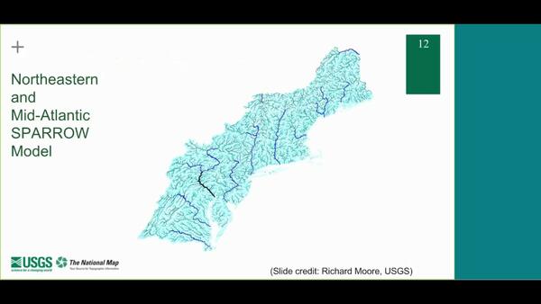
This lesson will provide a brief overview of the National Hydrography Dataset, Watershed Boundary Dataset and 3D Elevation program. This lesson will also discuss NHDPlus and introduce NHDPlus high resolution and tell you how to get the data.
How do I download hydrography data products?
Download USGS hydrography data (datasets representing U.S. surface water for mapping and modeling applications) using The National Map Downloader or using download links that are listed at Access National Hydrography Products.
Learn more:
- The National Map: Hydrography Training Videos
- National Hydrography Dataset User Guide
- For streamflow data, see: Where can I get real-time and historical streamflow information?
Related
How should I cite datasets and services from The National Map?
In what scale are the data in the National Hydrography Dataset (NHD)?
What formats are available for hydrography data products in The National Map?
What is the National Hydrography Dataset (NHD)?
What sources were used to produce the National Hydrography Dataset (NHD)?
Where can I get real-time and historical streamflow information?
This lesson will provide a brief overview of the National Hydrography Dataset, Watershed Boundary Dataset and 3D Elevation program. This lesson will also discuss NHDPlus and introduce NHDPlus high resolution and tell you how to get the data.
 Hydrography Seminar Series - Session 9 (NHDPlus HR)
The USGS Hydrography Seminar Series shares success stories from users, provides information on the National Hydrography Dataset (NHD), Watershed Boundary Dataset (WBD), NHDPlus High Resolution (NHDPlus HR), and other related products, and provides a forum for users to learn more about hydrography-related topics. Seminar 9 is an overview of the NHDPlus HR.
The USGS Hydrography Seminar Series shares success stories from users, provides information on the National Hydrography Dataset (NHD), Watershed Boundary Dataset (WBD), NHDPlus High Resolution (NHDPlus HR), and other related products, and provides a forum for users to learn more about hydrography-related topics. Seminar 9 is an overview of the NHDPlus HR.
Monitoring the Earth's Landscape with Low-Cost High-Tech
by Rian Bogle, Remote Sensing Specialist
Monitoring the Earth's Landscape with Low-Cost High-Tech
by Rian Bogle, Remote Sensing Specialist
User's guide for the national hydrography dataset plus (NHDPlus) high resolution
The National Map—New data delivery homepage, advanced viewer, lidar visualization
NHDPlusHR: A national geospatial framework for surface-water information
The National Map hydrography data stewardship: what is it and why is it important?
Watersheds: where we live
Related
How should I cite datasets and services from The National Map?
In what scale are the data in the National Hydrography Dataset (NHD)?
What formats are available for hydrography data products in The National Map?
What is the National Hydrography Dataset (NHD)?
What sources were used to produce the National Hydrography Dataset (NHD)?
Where can I get real-time and historical streamflow information?
This lesson will provide a brief overview of the National Hydrography Dataset, Watershed Boundary Dataset and 3D Elevation program. This lesson will also discuss NHDPlus and introduce NHDPlus high resolution and tell you how to get the data.
This lesson will provide a brief overview of the National Hydrography Dataset, Watershed Boundary Dataset and 3D Elevation program. This lesson will also discuss NHDPlus and introduce NHDPlus high resolution and tell you how to get the data.
 Hydrography Seminar Series - Session 9 (NHDPlus HR)
The USGS Hydrography Seminar Series shares success stories from users, provides information on the National Hydrography Dataset (NHD), Watershed Boundary Dataset (WBD), NHDPlus High Resolution (NHDPlus HR), and other related products, and provides a forum for users to learn more about hydrography-related topics. Seminar 9 is an overview of the NHDPlus HR.
The USGS Hydrography Seminar Series shares success stories from users, provides information on the National Hydrography Dataset (NHD), Watershed Boundary Dataset (WBD), NHDPlus High Resolution (NHDPlus HR), and other related products, and provides a forum for users to learn more about hydrography-related topics. Seminar 9 is an overview of the NHDPlus HR.
Monitoring the Earth's Landscape with Low-Cost High-Tech
by Rian Bogle, Remote Sensing Specialist
Monitoring the Earth's Landscape with Low-Cost High-Tech
by Rian Bogle, Remote Sensing Specialist


