
2000s
Here are documents from the 2000s associated with the history of the Earth Resources Observation and Science (EROS) Center. Click the links to download and view the files.


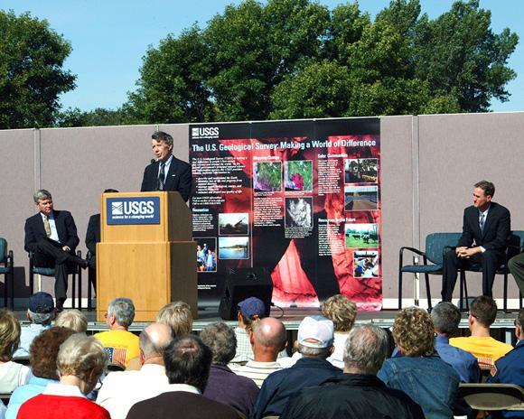

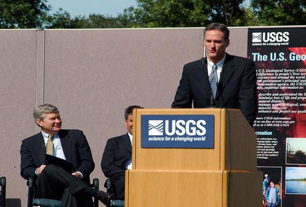


30th Anniversary
30th Anniversary General Announcement
2003 30th Anniversary Invitation
2003 30th Anniversary News Release
2003 30th Anniversary Speaker List
2003 30th Anniversary Newsletter
2003 30th Anniversary Educational Activities Pamphlet
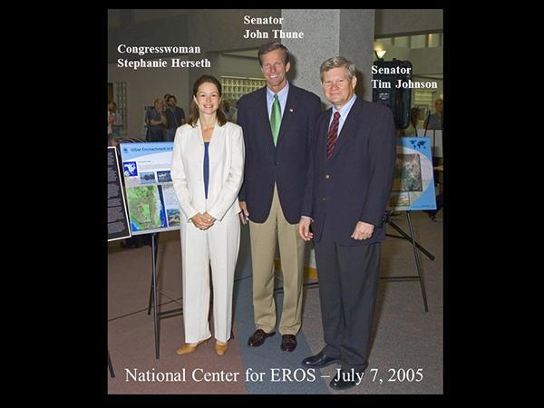
2003 30th Anniversary Tim Johnson Congressional Record
2003 30th Anniversary Event Schedule
2003 30th Anniversary Welcome Statement
Annual Reports
2000 EROS Data Center Annual Report
2000 EROS Data Services Annual Report
2004 EROS National Center Annual Report
2005 Land Remote Sensing (LRS) Annual Report
2006 Land Remote Sensing (LRS) Annual Report
2001 EROS Data Center Annual Data Sales Report
2009 EROS Center Annual Report
Annual Sales Reports
2001 EROS Data Center Annual Data Sales Report
2002 EROS Data Center Annual Data Sales Report
2003 EROS Data Center Annual Data Sales Report
Documents
1998-2008 Strategic Direction Report
2000 EROS Exploring a Changing Planet Pamphlet
2000 Preserving a Record of the Earth's Surface Pamphlet
2000 Earth Explorer Fact Sheet
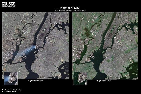
2001 EROS Response to September 11, 2001 Memos
2001 Earth Explorer Past and Present Browse Strategies Document
2001 Landsat 4/5 Operations to End News Release
2001 Senator Tim Johnson to Chairman Robert Byrd & Chairman Joe Skeen
2003 September 7 Argus Leader EROS Article
2003 Midwest Archives Conference (MAC) Award Letter
2003 USGS Tracking Change Over Time Educational Pamphlet
2003 Long-term Ramifications Of The Landsat 7 Failure Report
2003 Proposed Data Sieve Report
2003 Archivist Award Presentation Speech
2003 Honorable Gale Norton from Tom Daschle, Tim Johnson and Bill Janklow Letter
2004 National Center for EROS Charter
2004 Landsat Data Continuity Strategy OSTP memo 08-13-2004
2004 Tsunami Hazard Data Distribution System (HDDS) Diagram
2004 Advanced Spaceborne Thermal Emission and Reflectoin Ratiometer (ASTER) Tsunami Impact Image
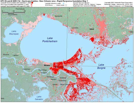
2004 Tsunami Northern Sumatra Damaged Areas Image
2004 Tsunami Northwest Sumatra Before and After Images
2004 USGS Reduces Price for Landsat 7 Scenes News Release
2004 Documenting Our Changing Planet Pamphlet
2004 Tsunami Case Study Presentation
2004 EROS Response to the Asian Tsunami Disaster Report
2004 Ramifications of the Landsat 7 Failure Report
2004 Tsunami Shuttle Radar Topography Mission (SRTM) Western Sumatra Coast Report
2004 Tsunami Population Density Report
2004 Lewis and Clark Bicentennial Pamphlet
2004 Photographic Laboratory De-Commission Report
2004 USGS to Stop Photographic Production News Release
2004 Daschle, Johnson Say EROS Receives Funds to Protect Jobs News Release
2004 Johnson Receives Commitment from Secretary Norton on Funding for EROS News Release
2004 Daschle, Johnson Call on Norton to Provide Promised Funding for EROS News Release
2005 Senator Tim Johnson to President George W. Bush Landsat Support Letter
2005 Geographic Information Science Center for Excellence (GIScCE) Brochure
2005 Geographic Information Science Center for Excellence (GIScCE) Collaboration Pamphlet
2005 SDSU Geographic Information Science Center for Excellence (GIScCE) News Release
2005 USGS Geographic Information Science Center for Excellence (GIScCE) News Release
2005 Geographic Information Science Center for Excellence (GIScCE) Overview Presentation
2005 Geographic Information Science Center for Excellence (GIScCE) SD Board of Regents News Release
2005 Landsat Data Continuity Strategy Adjustment OSTP memo 12-23-2005
2005 Thermal Infrared Sensor (TIRS) Western States Water Council Letter
2005 Landsat 5 Experiencing Technical Difficulties News Release
2005-2010 National Center for EROS Strategic Plan Statement
2005 Geographic Information Science Center for Excellence (GIScCE) Informational Report
2005 UNEP "One Planet Many People" Atlas
2005-2015 Geography for a Changing World Circular
2006 Women of EROS Sioux Falls Woman Article
2006 Thermal Infrared Sensor (TIRS) Association of Western State Engineers Letter
2006 Thermal Infrared Sensor (TIRS) Irrigation Association Letter
2006 Thermal Infrared Sensor (TIRS) U.S. Society for Irrigation and Drainage Professionals Letter
2006 Thermal Infrared Sensor (TIRS) Western Governers Association Letter
2006 Thermal Infrared Sensor (TIRS) Western States Water Council Letter
2006 Landsat 5 Resumes Operations News Release
2006 National Space Policy Excerpts
2007 NASA and USGS Landsat Data Continuity Mission (LDCM) Final Implementation Agreement
2007 Thermal Infrared Sensor (TIRS) Department of Conservation and Natural Resources Letter
2007 Thermal Infrared Sensor (TIRS) Boston University Letter
2007 Thermal Infrared Sensor (TIRS) US Senators Salazar and Crapo Letter
2007 Thermal Infrared Sensor (TIRS) US Senate Letter
2007 Thermal Infrared Sensor (TIRS) US Senate to Committee Letter
2007 Thermal Infrared Sensor (TIRS) Western States Water Council Letter
2007 R.J. Thompson Honorary Degree Pamphlet
2007 A Plan for U.S. National Land Imaging Program
2007 Landsat Data Continuity Mission (LDCM) House of Representatives Resolution
2008 Science Magazine Free Access to Landsat Imagery Article
2008 Free Landsat Image Archive News Release
2008 Landsat 5 Satellite Back in Action News Release
2008 USGS-NARA Affiliated Relationship Memo
2008 USGS-NARA Affiliated Relationship for Aerial Photography Press Release
2008 Landsat Data Continuity Mission (LDCM) NASA to Congress Report
2008 Imagery for Everyone..Timeline Set to Release Entire USGS Landsat
2008 Landsat Data Distribution Policy 2008
2008 USGS Accelerates Access to Satellite Data News Release
2009 Landsat 5 Experiences Malfunction (Updated) News Release
2009 Landsat 5 Fully Operational After Brief Interruption News Release
2009 National Land Imaging Program Pamphlet
2009 Landsat 5 Celebrates 25 Years Pamphlet
Archive Advisory Committee
2000 April Archive Advisory Committee Meeting Notes
2000 Archive Advisory Committee White Paper
2000 NSLRSDA Archive Advisory Committee Restricted Data White Paper
2001 March Archive Advisory Committee Meeting Notes
2001 October Archive Advisory Committee Meeting Notes
2002 May Archive Advisory Committee Meeting Notes
2002 October Archive Advisory Committee Meeting Notes
2003 Archive Advisory Committee Basic Data Set Definition
2003 Archive Advisory Committee Unenhanced Data Definition
2003 NSLRSDA Archive Advisory Committee, Secretary Norton Final Report
2003 USGS Acceptance Speech for NARA Archivist Award
2003 NSLRSDA USGS Response to Archive Advisory Comittee Final Report to Secretary Norton
2004 October Archive Advisory Committee Meeting Notes
2005 April Archive Advisory Committee Recommendations
2005 October Archive Advisory Committee Recommendations
2006 April Archive Advisory Committee Recommendations
2006 July Artchive Advisory Committee Meeting Notes
2006 National Satellite Land Remote Sensing Data Archive (NSLRSDA) Recommendation Letter
PECORA XV 2002
PECORA XVI 2005
2005 PECORA XVI Steering Committee List
2005 Pecora 16 Call for Papers
2005 Pecora 16 Preliminary Program
PECORA XVII 2008
2008 PECORA XVII Program Pamphlet
2008 PECORA XVII Call for Abstracts Report
2008 PECORA XVII Proceedings Report
2008 ASPRS PECORA XVII Proceedings