Boston University Professor Curtis Woodcock talks about the significance Landsat was had in science and what he hopes to see as the mission continues.
Videos
Watch and learn more about the land remote sensing program that changed the world by opening the door to long-term civilian satellite observation.
 Landsat in Action - The Importance of Landsat with Curtis Woodcock
Boston University Professor Curtis Woodcock talks about the significance Landsat was had in science and what he hopes to see as the mission continues.
 Landsat in Action - Forestry Research with Warren Cohen
Warren Cohen with the USDA Forest Service talks about the value of Landsat's long history of observations in monitoring and assessing forests.
Warren Cohen with the USDA Forest Service talks about the value of Landsat's long history of observations in monitoring and assessing forests.
 Landsat in Action - Monitoring Crop Land with Martha Anderson
Martha Anderson with the US Department of Agriculture talks about the value of Landsat and its thermal data in studying agricultural land.
Martha Anderson with the US Department of Agriculture talks about the value of Landsat and its thermal data in studying agricultural land.
February 11 will mark the 5th anniversary of the launch of Landsat 8!
Since 2013, over 1.1 million scenes have been acquired, adding to the Landsat archive which started almost 45 years ago, and continue to help support studies in agriculture, forest and water quality/use/management, natural disasters, and land change.
 Landsat in Action - Minnesota Lakes with Leif Olmanson
Leif Olmanson from the University of Minnesota talks about the value of Landsat data in monitoring the thousands of lakes in Minnesota.
Leif Olmanson from the University of Minnesota talks about the value of Landsat data in monitoring the thousands of lakes in Minnesota.
 Landsat in Action - Monitoring Canada's Forest with Mike Wulder
Mike Wulder with Canada's Forest Service talks about the value Landsat images have for mapping and monitoring Canada's forested areas.
Mike Wulder with Canada's Forest Service talks about the value Landsat images have for mapping and monitoring Canada's forested areas.
 Landsat in Action - Tracking Water Changes with John Schott
John Schott with the Rochester Institute of Technology discusses using Landsat Data over the years, and how its Thermal data tracks temperature changes in water bodies.
John Schott with the Rochester Institute of Technology discusses using Landsat Data over the years, and how its Thermal data tracks temperature changes in water bodies.
 Landsat in Action - Changing Forest Phenology with Andrew Elmore
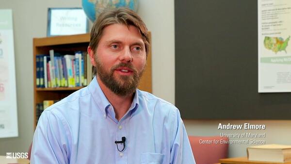
When parking lots go up, when rooftops multiply, land cover and land uses change. Professor Andrew Elmore with the University of Maryland’s Center for Environmental Science understands that very well, and explains how he uses Landsat to study and quantify that change in USGS EROS’ latest “Landsat in Action” video conversation.
When parking lots go up, when rooftops multiply, land cover and land uses change. Professor Andrew Elmore with the University of Maryland’s Center for Environmental Science understands that very well, and explains how he uses Landsat to study and quantify that change in USGS EROS’ latest “Landsat in Action” video conversation.
Ever wonder how Landsat 8 orbits our planet? Here is an overview to explain this part of how we capture every pixel.
Ever wonder how Landsat 8 orbits our planet? Here is an overview to explain this part of how we capture every pixel.
On board Landsat 8 are two sensors that capture data about earth's surface. Here is an explanation of the instruments that capture every pixel.
On board Landsat 8 are two sensors that capture data about earth's surface. Here is an explanation of the instruments that capture every pixel.
Recording every pixel as Landsat orbits Earth is a complicated task. Here is an overview of how that data goes from the sensors into the recorder.
Recording every pixel as Landsat orbits Earth is a complicated task. Here is an overview of how that data goes from the sensors into the recorder.
Every pixel of Landsat data is transmitted down to a network of ground stations around the world. Here is an overview of how that happens.
Every pixel of Landsat data is transmitted down to a network of ground stations around the world. Here is an overview of how that happens.
Once the ground stations receive data from Landsat, there's still a lot of processing to make every pixel usable. Here's an overview of some of that work.
Once the ground stations receive data from Landsat, there's still a lot of processing to make every pixel usable. Here's an overview of some of that work.
 Landsat in Action — Open Data in Australia with Adam Lewis
Geoscience Australia's Acting Chief Scientist Adam Lewis talks about the value of Landsat data, the importance of free and open policy, and how analysis ready data is advancing earth observing science.
Geoscience Australia's Acting Chief Scientist Adam Lewis talks about the value of Landsat data, the importance of free and open policy, and how analysis ready data is advancing earth observing science.
 Landsat In Action - Monitoring Polar Ice Caps with Ted Scambos
Ted Scambos, Lead Scientist at the National Snow & Ice Data Center, talks about the roll of Landsat in his research studying polar regions.
Ted Scambos, Lead Scientist at the National Snow & Ice Data Center, talks about the roll of Landsat in his research studying polar regions.
 Landsat In Action - Assessing Global Impact with Alan Belward
Alan Belward from the European Union's Joint Research Center discusses how Landsat helps his team promote sustainable development.
Alan Belward from the European Union's Joint Research Center discusses how Landsat helps his team promote sustainable development.
More than 7 million Landsat satellite images now available.
More than 7 million Landsat satellite images now available.
 2013 Landsat Data Continuity Mission LDCM Hand off Video
A video on the 2013 Landsat Data Continuity Mission Landsat Data Continuity Mission hand off
A video on the 2013 Landsat Data Continuity Mission Landsat Data Continuity Mission hand off
A "Top Ten" video of locations featuring land change, as captured by USGS Landsat
A "Top Ten" video of locations featuring land change, as captured by USGS Landsat
A video celebrating the 25th Anniversary of Landsat 5.
A video celebrating the 25th Anniversary of Landsat 5.


